Download Waze – GPS, Maps, Traffic Alerts v4.83.0.4 Beta [Chuppito Mod]

Waze – GPS, Maps, Traffic Alerts v4.83.0.4 Beta [Chuppito Mod]
Requirements: 5.0 and up
Overview: Waze is the world’s largest community-based traffic and navigation app. Join drivers in your area who share real-time traffic & road info to save time, gas money, and improve daily commuting for all.

Image

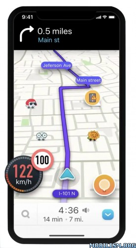
Just by driving with Waze open, you’re already contributing tons of real-time traffic information to your local community. You can also actively report accidents, police traps and other hazards you see on the road. Get road alerts along your route and find the cheapest gas prices around you shared by the community. Plus, you can add friends, send locations or keep others posted on your arrival time.

– Live routing based on community driven, real-time traffic & road info
– Community reported alerts including accidents, hazards, police traps, road closures, and more
– Turn-by-turn voice guided navigation
– Live maps, consistently edited and updated by Waze community map editors
– Automatic rerouting as conditions change on the road
– Send your ETA & real-time drive to update those you’re meeting
– Learns your frequent destinations, commuting hours, and preferred routes
– Find the cheapest gas station on your route
– Add information on local places and businesses
– Add Facebook friends and sync Contacts
– See friends’ ETA when driving to the same destination
– One tap navigation to Facebook & Calendar events
– Earn points as you contribute road info and climb the ranks in your community

Waze is all about contributing to and benefiting from the common good, so hop on board and get involved!

Note: Continued use of GPS running in the background can dramatically decrease battery life. Waze will automatically shut down if you run it in the background and haven’t driven for a while.

Learn more about the Waze privacy policy, including what information is accessed and how it is used. With Waze, you have full control over your privacy settings. _http://www.waze.com/legal/privacy/

MOD features:
Decensored Waze version with the following improvements compared to the official version:
– display of the exact location of fixed or mobile speed cameras.
– enlarged speed limit sign for more readability
– Radar sound alert whatever the speed (only in case of speeding with the official version)
– personalized card skin with black background to save battery and improve readability
– Choice of new voices compared to the official version
– Vanessa (unmodified),
– Morgan (Cars voice is pretty cool), if you prefer Morgan’s real voice, delete the folder in waze / sound / french
– Svenska (French voice, sound boosted),
– Srpski (star wars voice the 1st voice after the English voices).
– transparent gray signal button (instead of a solid orange circle in the official version) for more map readability and to avoid the "burn" effect on the AMOLED screen
– possibility to report bad or no limitation by clicking on the speedometer then choose "report" (option absent in official version)
– announcement distance of the modified controls compared to the official version:
– highway at 1500 m
– Fast lanes at 1200 m
– Roads at 1000 m

NB; distance configurable in the "Preferences" file by adjusting these 2 lines:
Alerts.Alert Distanc_: 1000
Alerts.Police Alert Distac_: 1000

Speed ​​camera warnings have been officially banned in France since January 2012, their use is punishable by a fine of 1,500 euros and a withdrawal of 6 points on the driving license.

By installing this version, you remain responsible for its use.
Namely in France according to the law still in force to this day: The police do not have the right to search your smartphone.

What’s New:
New Beta release v.4.83.0.4. Please visit Centercode for full release notes and to submit your feedback.

Fixed:
Stability fixes and improvements

This app has banner and credit advertisements

More Info:
https://play.google.com/store/apps/details?id=com.waze&hl=en

Download Instructions:
https://ouo.io/NRhOZPH

Mirrors:
https://rapidgator.net/file/8405546586f … e.apk.html
https://ouo.io/RvXtjI
Download Map Coordinates v5.2.5 [Pro] [Mod Extra]

Map Coordinates v5.2.5 [Pro] [Mod Extra]
Requirements: 5.0+
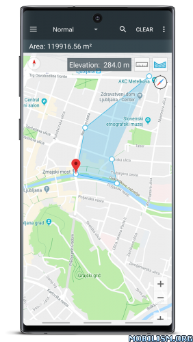
Overview: Map Coordinates will help you retrieve the coordinates and/or address of a specific location on the map. It is easy to use and very intuitive.

Image

A single tap on the map gives you access to world coordinates. In addition, Map Coordinates offers a full set of tools like distance measurement, current GPS location, history / favorite locations, share location, find location or copy coordinates / address. You can switch between multiple coordinate types like decimal degrees, DMS (degrees, minutes and seconds) or even special types like what3words, MGRS or UTM.

The app is designed to easily determine the coordinates and address of a point on the map and share them with friends via SMS, email or social apps.

When you need to find a location, you can either type / paste the address / coordinates in a search field or enter each coordinate value one by one in it’s own field using the advanced search options. what3words, UTM and MGRS can be searched for only by using the single search field.

The current GPS location is best received while the mobile device is located outdoors. The GPS satellites are easy to be found when there is no interference like buildings or clouds. Even if the device is located indoor, the location can be accurately found through WiFi network but only if the device is connected to that network.

The side drawer menu is used to navigate between different parts of the app like History / Favorites but it is also used to switch the map provider. The available map providers are Google Maps and Open Street Maps, each of them having different map types. Under Open Street Maps there is also a compass available all the time.

Settings can also be accessed from the side navigation drawer. There you have the options to switch between existing coordinates types, change the visibility of the address bar or you can enable the Distance measure tool and the Elevation tool. Elevation displays the altitude of the selected location on the map.

We hope that this app fulfills your needs but if you have any other expectations, please don’t hesitate to contact us and we will try to help you out.

What’s New:
– Added a waypoint tool to show speed, direction and distance from current location, towards the selected point on the map. The feature can be enabled in Settings – Tools – Waypoint direction

Mod Info:

  • MGRS coordinates type unlocked;
  • UMT coordinates type unlocked;
  • Remove Ads unlocked;
  • Measurement Tools unlocked;
  • Disabled / Removed unwanted Permissions + Receivers + Providers + Services;
  • Optimized and zipaligned graphics and cleaned resources for fast load;
  • Ads Permissions / Services / Providers removed from Android.manifest;
  • Ads links removed and invokes methods nullified;
  • Ads layouts visibility disabled;
  • Google Maps Location works;
  • Google Play Store install package check disabled;
  • Debug code removed;
  • Remove default .source tags name of the corresponding java files;
  • Analytics / Crashlytics / Firebase disabled;
  • No active trackers or advertisements;
  • Languages: Full Multi Languages;
  • CPUs: armeabi-v7a, arm64-v8a;
  • Screen DPIs: 120dpi, 160dpi, 240dpi, 320dpi, 480dpi, 640dpi;
  • Original package signature changed;
  • Release by Balatan.

This app has no advertisements

More Info:
https://play.google.com/store/apps/details?id=sands.mapCoordinates.android

Download Instructions:
https://ouo.io/8wF7sW

Mirrors:
https://ouo.io/sYU9hu
https://ouo.io/doSOSY8
https://ouo.io/zj32Ut
https://ouo.io/K6hLO0M
https://ouo.io/BG2PIm
https://ouo.io/qxI3X6
https://ouo.io/17ZLAp

Download Tools for Google Maps v5.24 [Mod Extra]

Tools for Google Maps v5.24 [Mod Extra]
Requirements: 4.1+
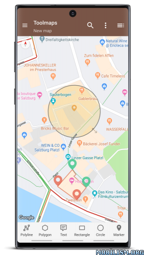
Overview: Tools for Google Maps to highlight, edit and capture maps from Google Maps.

Image

The maps from Google Maps are shown in full screen mode or immersive mode without any object to interfere.

You can add and edit polylines, polygons, rectangles, circles and markers.
You can also add text with colors, resize and rotate them
All colors support transparency.

Others features:
• calculate perimeters and areas of polygons
• calculate distance between two points
• import / export to kml format
• easy command to take a snapshot of the map using the entire screen
• address search function
• support all the gesture from google maps
• from the navigation drawer easy switch from different map mode: normal, satellite, hybrid, terrain
• options to enabled compass, buildings, traffic, indoor
• one touch to enter / leave fullscreen mode
• support immersive mode for Android 4.4 devices or superior

What’s New:
• See in the app

Mod Info:

  • Add removed / disabled;
  • Disabled / Removed unwanted Permissions + Receivers + Providers + Services;
  • Optimized and zipaligned graphics and cleaned resources for fast load;
  • Ads Permissions / Services / Providers removed from Android.manifest;
  • Ads links removed and invokes methods nullified;
  • Ads layouts visibility disabled;
  • Google Maps Location works;
  • Google Play Store install package check disabled;
  • Debug code removed;
  • Remove default .source tags name of the corresponding java files;
  • Analytics / Crashlytics / Firebase disabled;
  • Languages: Full Multi Languages;
  • CPUs: universal architecture;
  • Screen DPIs: 160dpi, 240dpi, 320dpi, 480dpi, 640dpi;
  • Original package signature changed;
  • Release by Balatan.

This app has no advertisements

More Info:
https://play.google.com/store/apps/details?id=com.service.fullscreenmaps

Download Instructions:
https://ouo.io/mZtfrh

Mirrors:
https://ouo.io/VpKJqP
https://ouo.io/SEmFPY
https://ouo.io/ywIIsZ
https://ouo.io/T1sNUUG
https://ouo.io/YmTIaXC
https://ouo.io/OTuDFG
https://ouo.io/aaL0UQ

Download Sygic Truck GPS Navigation v22.1.0 Final [Unlocked][Mod]

Sygic Truck GPS Navigation v22.1.0 Final [Unlocked][Mod]
Requirements: 4.0+
Overview: GPS TRUCK NAVIGATION BY SYGIC, MAKER OF THE WORLD’S MOST INSTALLED OFFLINE GPS NAVIGATION APP

Image

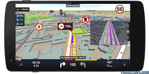
– GPS Navigation for truck drivers with truck restrictions in the map
– Special routing for RV/Caravan/Camper and Bus drivers
– Maps stored on device, internet connection is not required, works with GPS signal
– Try 14 days for free, full license available for 129 EUR Europe, 139 USD North America, 179 AUD Australia & New Zealand, 139 EUR South Africa, 169 EUR Middle East
– Free map updates for 3 years
Available maps: Europe & Russia, North America, Australia & New Zealand, South Africa, Middle East
_______________________________________
HIGHLIGHTS
– High quality Nokia maps stored on the device
– Works with GPS only, internet is not needed
– Turn-by-Turn navigation voice instructions

FOR TRUCK
– Set truck parameters and hazardous materials
– Avoid roads not suitable for your truck/cargo
– Truck parking and petrol stations as POI
– Waypoints for multiple places of loading/unloading

FOR RV/Caravan and BUS
– Profile configuration for RV/Caravan and bus
– Campgrounds and parking stations as POI
– Avoid detours and narrow roads

OTHER FEATURES
– Spoken Street Names to focus on the road
– Dynamic Lane Guidance to know the right lane
– Speed Limit Display and Speed Camera Warnings
_______________________________________
BENEFITS
– Free Updates for 3 years: map, POI, speed cam
– 3D Cities & Landscape for easy orientation
– One application for TRUCK, RV/CARAVAN/CAMPER, BUS or CAR drivers
_______________________________________
SAFETY AND USER COMFORT
– Notification of Upcoming Speed Limit Change
– Avoid roads not suitable for trucks or RV
– Avoid Toll Roads on part or on entire route
– Avoid Roadblocks, Motorways …
_______________________________________
GREAT SEARCH
– Google™ Local Search to find anything
– Exact address numbers
– Find and Navigate to
• Address
• Contact
• POI
• Postal code
• Intersection
• GPS coordinates
• Home
_______________________________________
APP THAT IS PERSONAL
– Import of interesting locations – POIs
– Customizable navigation screen
– Road Incident Sharing with other drivers
– SOS/Help to find assistance nearby
– Customizable spoken warnings
_______________________________________
COMPATIBLE TO THE MAX
– Smooth Hardware Accelerated 3D rendering
– Car Audio Integration – Bluetooth or cable
– Graphics optimized for tablet & HD displays

What’s New:
Minor experience improvements

Note:
Start the app – then quit out of the app when you see the screen that says "one moment please"

This app has NO advertisements

More Info:
https://play.google.com/store/apps/details?id=com.sygic.truck

Download Instructions: Credits Mrdude
https://ouo.io/P3HGAw

Mirror:
https://ouo.io/lSppxTO

Download REVER – Motorcycle GPS, Route Planner & Discover v5.2.2 [Pro]

REVER – Motorcycle GPS, Route Planner & Discover v5.2.2 [Pro]
Requirements: 6.0+
Overview: The journey is about so much more than the destination. The world’s largest motorcycle, snowmobile and offroad GPS app and community is all about helping you enjoy the ride, relive the route, and share it with your friends.

Image Image

The motorcycle, offroad & snowmobile app to track & guide your riding experience

The journey is about so much more than the destination. The world’s largest motorcycle, snowmobile and offroad GPS app and community is all about helping you enjoy the ride, relive the route, and share it with your friends. From planning to navigating to sharing, REVER aims to enhance the entire experience, making it more fun & memorable, while offering convenience and technology to every ride. If you rev, REVER IT! Plan. Track. Share.

Built specifically for route discovery & navigation REVER turns your mobile phone into a fully functioning GPS device for your motorcycle atv snowmobile or 4×4 vehicle. Create your dream ride experience with thousands of scenic roads trails and best areas to explore and ride in-app planning for custom routes turn-by-turn GPS navigation offline maps 3D playback & more!

FREE POWERSPORTS AND OFFROAD APP FEATURES

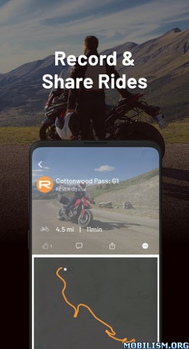
Record distance duration elevation and speed on all your rides. Keep them public or mark as private.
Web planner for scouting at homem to create and auto sync planned routes to your mobile device. Website http://www.rever.co
Satellite and topographic maps with route line navigation
Stay motivated by competing in challenges
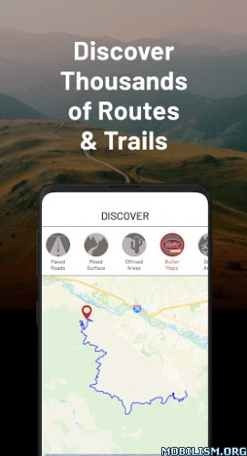
Discover thousands of miles of hand-curated routes and places to explore from around the globe.
Input vehicles into your garage
Add your riding gear into the app
Import GPX files into your REVER profile through http://www.rever.co

CONNECT AND SHARE
Your recorded rides display in your REVER feed so friends and followers can like and comment
Join brands events rallies and friends in a REVER community
Share your route and share photos of your adventure on social media

PRO MEMBERSHIP:
Unlock access to the most robust navigation tools and features. Pro membership gives you access to:
Custom turn-by-turn directions with voice navigation
Weather radar and alerts
See adventures in 3D Flyover and Explore
LiveRIDE Safety Features and automated safety SMS alerts
Mobile-route planning
Plan routes in 3D
Save Offline maps and rides
In app GPX import
Download GPX files
Butler Maps highlighted road recommendations
Point-of-interest with campgrounds gas stations restaurants & hotels
Create communities
Premium Map Styles
Ad-free experience

OFFLINE GPS
Turns your phone into the best GPS using the built-in GPS to navigate you through your route. No cellular network needed. You can even record rides in airplane mode.
Download offline rides and maps for off-the-grid adventures

NOT JUST FOR TWO WHEELS
Track a whole range of powersports and off-road activities including; side-by-side (SxS) ATV UTV snowmobile trikes Spyder scooter personal watercraft Sea-Doo Slingshots Ford Raptor Jeeps 4x4s and more.

MANAGE SUBSCRIPTION
Subscription automatically renews unless auto-renew is turned off at least 24-hours before the end of the current period. Your card will be charged for renewal within 24-hours prior to the end of the current period and identify the cost of the renewal.
Payment will be charged through Google Play at confirmation of purchase.
Visit the following URL for full terms of use: https://www.rever.co/privacy-policy
Your subscription can be managed with Google Play: https://play.google.com/store/account

FEEDBACK:

We are riders just like you. If you have a problem suggestion or just want to request new features please contact us at support@rever.co

Note: Continued use of GPS running in the background can dramatically decrease battery life.
*If you are experiencing issues with tracking adjust your Power Save settings to Performance.

What’s New:
We update REVER as often as we can, check in weekly to make sure you have the latest fixes and features.

This app has no advertisements.

More Info:
https://play.google.com/store/apps/details?id=com.reverllc.rever

Download Instructions
https://ouo.io/K45ANM

Mirror:
https://ouo.io/xeNq0tX