Download OruxMaps Donate v9.0.1.GP [Patched] [Mod Extra]

OruxMaps Donate v9.0.1GP [Patched] [Mod Extra]
Requirements: 4.2+
Overview: Map viewer/route logger for your outdoor activities.

ImageImage

IMPORTANT!: NOT ALL ONLINE MAP SOURCES ARE NOW DOWNLOADABLE. SELECT ANOTHER SOURCE IF YOU CAN NOT FIND THE OPTION TO DOWNLOAD A MAP.

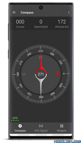
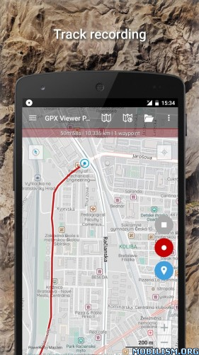
Map viewer, track logger.
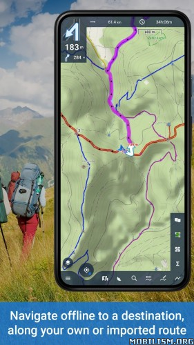
You can use OruxMaps for your outdoor activities (running, treking, mountain bike, paragliding, flying, nautic sports,….)

100% no adversisements

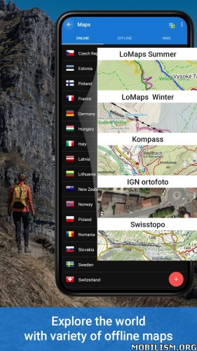
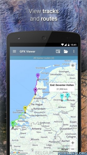
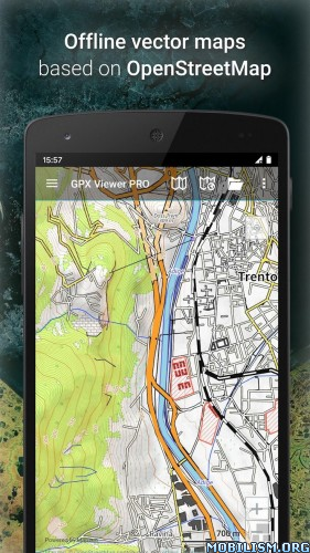
Online and offline maps. Support to multiple formats:
-OruxMaps format. You can use maps from Ozi Explorer transformed wit a PC tool.
-GeoPDF (experimental) from USGS store, for example.
-.ozf2
-.img garmin (vectorial) -no full support is provided-.
-.mbtiles
-.rmap
-.map (vectorial from mapsforge). Support to custom themes similat than Locus themes.

Support to Wms, you can use the application as a WMS viewer.
Support to APRS sources.
3D view.

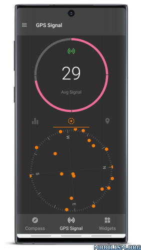
Support to multiple external devices:
-GPS bluetooth.
-Heart rate monitors, bluetooth Zephyr, Polar (including bluettoh smart devices, like polar H7).
-ANT+ (speed, cadence, heart rate, distance,…).
-AIS information systems (experimental), for nautical sports, using Wifi o BT.

More features:
Support to KML KMZ and GPX formats.
Share your position with your friends, display the position of your friends in your device.
Download online maps for offline use.
Text to speech support.
Profiles; save your preferences in your SD card.
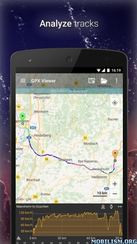
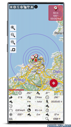
Statistics with graphics.
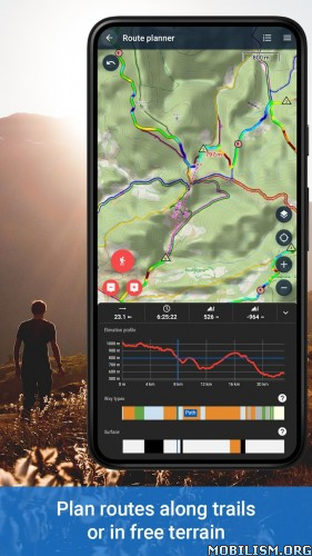
Follow routes, with different alarms to alert you if you are near a waypoint, or you are far from the route.
Create/save wayponits, attaching photo/audio/video extensions.
Custom waypoints types, with your icons.
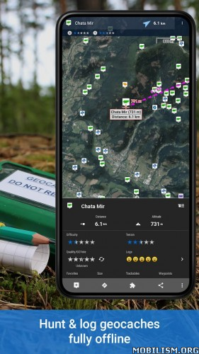
Basic support to Geocaching.
Correct the altitude of your tracks/routes using DEM files (offline) or online services.

Search/download tracks from:
-everytrail.com
-gpsies.com

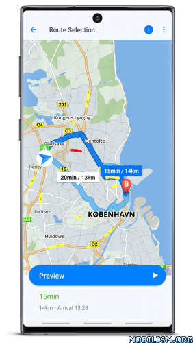
Search or create tracks using online services from Cloudmade or offline using Broute app.

Upload tracks to:
-mapmytracks.com
-trainingstagebuch.org
-ikimap
-wikirutas
-openxplora

Live tracking using:
-mapmytracks.com
-okmap application
-gpsgate protocol

What’s New:
—>Mapsforge library update to 0.17.
—>Adaptation to Android Scoped Storage.
—>Patterns with Waypoint names.
—>Colorized night maps.
—>Support to garmin extension (base camp routes) in gpx files.
—>New text to speech fields (altitude up/down).
—>Import geotagged pictures to your waypoints list.
—>Support to dinamic kml files.
—>Strava integration, added a new button in the Strava activities to see starred segments.
—>Added (long press the map) an option to search images in WikiMedia databases.
—>Added icons to mapsforge searchs (some categories).
—>New sensor, network status.
—>New menu options when pressing a Track.
—>Routes searched with brouter, added the option to include data of road type, surface, etc.
—>Edit the properties (name, description, color, fill, …) of each segment of a Track.
—>Added no-go points to brouter search engine.
—>New feature: Group waypoints if they overlap.
—>Range selection in waypoints/tracks lists.
—>Massive track properties modification.
—>Support for files in geojson format (tracks, polygons,…).
—>Secondary directory for maps.
—>Georeference map images and use them as maps or overlays (pdf, tiff, jpg,…).
—>Bug correction.

Mod Info:

  • No root or Lucky Patcher or Google Play Modded required;
  • Disabled / Removed unwanted Permissions + Receivers + Providers + Services;
  • Optimized and zipaligned graphics and cleaned resources for fast load;
  • Google Maps Location works;
  • Google Play Store install package check disabled;
  • Debug code removed;
  • Remove default .source tags name of the corresponding java files;
  • Analytics / Crashlytics / Firebase disabled;
  • Languages: Full Multi Languages;
  • CPUs: armeabi-v7a, arm64-v8a;
  • Screen DPIs: 160dpi, 240dpi, 320dpi, 480dpi, 640dpi;
  • Original package signature changed;
  • Release by Balatan.

This app has no advertisements

More Info:
https://play.google.com/store/apps/details?id=com.orux.oruxmapsDonate

Download Instructions:
armeabi-v7a:
https://ouo.io/QVtRxcR

Mirrors:
https://ouo.io/FTqxOB
https://ouo.io/ePkLlJ
https://ouo.io/GyRYlc
https://ouo.io/HP3J9P
https://ouo.io/meQxob
https://ouo.io/zEz7Rc

arm64-v8a:
https://ouo.io/w1EMIk

Mirrors:
https://ouo.io/nUlpyg
https://ouo.io/eK0tlP
https://ouo.io/qIfXow
https://ouo.io/ZYYfom
https://ouo.io/ymKtrqp

Download Compass and GPS tools v26.0.1 [Premium] [Mod Extra]

Compass and GPS tools v26.0.1 [Premium] [Mod Extra]
Requirements: 8.0+
Overview: Do you keep waiting long for GPS location when you open your favorite app like say Maps ?

ImageImage

• Compass – Magnetic Heading
• Navigation stats – Speed, Course, Altitude, Latitude and Longitude
• Satellite stats – Signal, Almanac, Ephemeris, Azimuth, Time and Fix Accuracy
• Keepalive – Keep GPS locked awake

Premium Features(Inapp Purchase):
• Adfree
• Keepalive widget

Technical Note:
It takes at least 3 to 4 satellites before you can receive location fix. Almanac(Imprecise) and Ephemeris(Precise) are satellite data cached in the GPS engine. The almanac data validity is in months. The ephemeris data gets invalidated in a few hours. If you get more satellites with valid ephemeris then you will quickly get location fixes with good accuracy.

What’s New:
• Android 12 compatibility

Mod Info:

  • Premium / Paid features unlocked;
  • Disabled / Removed unwanted Permissions + Receivers + Providers + Services;
  • Optimized and zipaligned graphics and cleaned resources for fast load;
  • Ads Permissions / Services / Providers removed from Android.manifest;
  • Ads links removed and invokes methods nullified;
  • Ads layouts visibility disabled;
  • Google Play Store install package check disabled;
  • Debug code removed;
  • Remove default .source tags name of the corresponding java files;
  • Analytics / Crashlytics / Firebase disabled;
  • No active trackers or advertisements;
  • Languages: Full Multi Languages;
  • CPUs: universal architecture;
  • Screen DPIs: 160dpi, 240dpi, 320dpi, 480dpi, 640dpi;
  • Original package signature changed;
  • Release by Balatan.

This app has no advertisements

More Info:
https://play.google.com/store/apps/details?id=com.cls.gpswidget

Download Instructions:
https://ouo.io/6qFxGw

Mirrors:
https://ouo.io/SLr8E4
https://ouo.io/Dp9tCW
https://ouo.io/me5CVC
https://ouo.io/l50BzP
https://ouo.io/RycO6B
https://ouo.io/9zwjfO

Download Locus Map 4 Outdoor Navigation v4.9.2 [Silver]

Locus Map 4 Outdoor Navigation v4.9.2 [Silver]
Requirements: 5.0 and up
Overview: Create, plan, edit, record, save or share your trips, keep the memories, track your performance, and much more. Locus Map is designed for hiking, mountain biking, cycling, running, geocaching, cross-country skiing, and other outdoor activities.

Image Image Image Image

More fun(ctions) for your adventures! Multifunctional navigation app with offline maps for a fully enjoyable outdoor experience.

Create, plan, edit, record, save or share your trips, keep the memories, track your performance, and much more. Locus Map is designed for hiking, mountain biking, cycling, running, geocaching, cross-country skiing, and other outdoor activities.

Fully customizable and flexible, offering a wide range of cool functions running above a variety of maps of the whole world.

Plan, record and manage your activities:

• plan routes along hiking trails, bike trails, or in an open terrain
• record tracks with all useful stats – distance, speed, pace, height gain, calorie burn, and other
• import and export the routes in various formats (GPX, KMZ, TCX…)
• share your tracks to Strava, Runkeeper, or Google Earth
• create your private database of interesting or favorite places
• browse your geotagged photos on the map
• import and export points of interest in various formats

Navigate and guide offline:
• turn-by-turn voice instructions or sound signals
• out-of route alert
• navigation and guidance along routes imported from elsewhere
• beeline guidance in an open terrain

Hunt for geocaches:
• download caches for offline play via G4L add-on
• navigate caches above the map or using the compass, log them online or offline
• use graphic and calculation tools
• manage your logs and drafts
• get alerted of an upcoming geocache

Customize your app:
• configure its main menu according to your actual needs
• set the main screen – function panels, right/left-hand control, light/dark mode…
• set coords system, units, dashboards and screens
• enjoy the app’s flexibility with the configuration presets

Use maps from our wide selection:

LoMaps – offline maps of the whole world
• switchable to hiking/biking map, winter or city map. Download 3 of them for FREE.

Outdoor maps by the world’s best cartographic publishers
• USA&Canada – USGS classic/satellite, AccuTerra trail maps, BackRoad Map Books,
• Europe – Ordnance Survey (UK), Kompass, Outdooractive, Freytag&Berndt (Germany, Austria, Italy), IGN (France, Belgium), CNIG (Spain), Lantmäteriet (Sweden), Kortforsyningen (Denmark), PZS (Slovenia), Compass (Poland), Swisstopo (Switzerland), SHOCart (Czechia, Slovakia) and many others…

• add external maps in SQLite, TAR, MBT, GEMF, Orux or RMA formats

Get even more with the Premium subscription

Go fully offline
• enjoy offline LoMaps of the whole world including updates without extra charges
• search offline addresses and LoPoints
• navigate and plan routes with the built-in offline router
• display elevation of any place on Earth without an internet connection

Keep synced
• use your tracks, routes, and points synced across multiple devices including web portal

Go web
• plan routes on a big PC screen, sync them with your mobile devices
• browse, view and manage your routes and tracks in a web library

Go live
• share your location in real-time with your family or friends in your own private groups

Sport packet
• connect the app with BT/ANT+ sensors
• work out with audio coach
• monitor your rides on a dashboard with handsfree screen control

Map tools
• calibrate map images
• overlay two various maps
• set map offset

And enjoy all other Premium features of the app
• 24/7 weather forecast on any place on Earth
• parking assistant
• no ads and LoCoin bonuses

App uses the Device Administrator permission

What’s New:
*** Locus Map 4.9 ***
A lot of tiny improvements and bug fixes across the whole app.

This app has no advertisements

More Info:
https://play.google.com/store/apps/details?id=menion.android.locus&hl=en

Download Instructions: credit Timozhai
https://ouo.io/evXoeT

Mirrors:
https://ouo.io/8m5l4kR
https://rapidgator.net/file/aa65928de42 … r.apk.html

Download GPX Viewer PRO v1.40.4 [Patched]

GPX Viewer PRO v1.40.4 [Patched]
Requirements: 5.0 and up
Overview: This simple application loads tracks, routes and waypoints from gpx, kml, kmz and loc files and draws them on different map types such as Google Maps, Mapbox, HERE and many types of OpenStreetMaps. Application shows detailed information about each track, route and waypoint. It also supports showing current GPS position on a map and continuously follows that position, so it can be used as a simple navigation.

Image Image Image Image

View gpx, kml, kmz, loc files, but get a lot more features. See why we are one of the best rated offline vector maps app. GPX Viewer PRO is the ultimate GPS locator, GPS tracks viewer, analyzer, recorder, tracker and simple navigation tool for your trips and outdoor activities.

GPX, KML, KMZ AND LOC
• view tracks, routes and waypoints from gpx, kml, kmz and loc files
• file browser which opens multiple files and has support for favorite files and history
• compress gpx files into gpz and kml files into kmz (zip archives)

DETAILED TRIP STATS
• analyze information and statistics for tracks and routes
• view graphs (charts) like elevation profile and speed profile for tracks and routes
• view graphs of other track data like cadence, heart rate, power and air temperature
• analyze information for waypoints and adjust their icons
• change track and route color
• colorize track and route line by elevation, speed, cadence, heart rate or air temperature

ONLINE MAPS
• online maps such as Google Maps, Mapbox, HERE, Thunderforest and some others based on OpenStreetMap data, preview: _https://sh.vecturagames.com/online
• OpenWeatherMap weather layers and overlays
• add your custom online TMS or WMS maps

SIMPLE NAVIGATION TOOL
• show current GPS position on a map
• follow GPS position continuously by adjusting map position
• rotate map according to device orientation sensor or according to movement direction data from GPS
• with follow GPS position and rotate map features, GPX Viewer PRO can be used as a simple navigation tool
• notification when GPS position is near waypoint with adjustable distance

OFFLINE MAPS (PRO ONLY)
• detailed worldwide offline vector maps based on OpenStreetMap data
• wide variety of offline map styles from city to outdoor oriented styles, preview: _https://sh.vecturagames.com/offline
• monthly updates with improved data

TRACK RECORDING (PRO ONLY)
• record and export your trips into gpx or kml files
• record elevation and speed statistics
• adjustable recording profiles for various outdoor activities
• distance or time voice notification

———

GPX Viewer PRO is highly customizable. You can set everything according to your needs!

If you want feature rich gpx viewer that is also offline maps app & tool with simple navigation, vector offline maps, GPS locator, GPS tracks viewer, trip stats viewer, GPS tracker and has other useful features, GPX Viewer PRO is the best app for that!

User Guide:
_https://docs.vecturagames.com/gpxviewer

User Support:
_https://support.vecturagames.com/gpxviewer

What’s New:
• updated German translation
• updated 3rd party libraries
• PRO fixed issue with enabling online map when no offline map data were downloaded

This app has no advertisements

More Info:
https://play.google.com/store/apps/details?id=com.vecturagames.android.app.gpxviewer.pro&hl=en

Download Instructions: credit Timozhai
https://ouo.io/YjyZKU

Mirror:
https://rapidgator.net/file/f4b92afb793 … d.apk.html
https://ouo.io/0grXsL

Download Sygic GPS Navigation & Maps v22.0.6 [Unlocked][Anymap][Mod]

Sygic GPS Navigation & Maps v22.0.6 [Unlocked][Anymap][Mod]
Requirements: 4.4+
Overview: Sygic GPS Navigation & Maps is the most advanced GPS navigation app for Android with 3D offline maps from TomTom, accurate door-to-door voice guided navigation and free map updates.

Image

Sygic – GPS, Navigation is the world’s most downloaded GPS navigation app, trusted by more than 200 million drivers. Offline 3D maps are stored on your phone for GPS navigation without an internet connection. We update the maps multiple times per year for free, so that you can always rely on Sygic GPS Navigation.

NAVIGATE ANYWHERE, EVEN WITHOUT AN INTERNET CONNECTION
• Offline maps of all countries in the world, from TomTom and other providers
• Free map updates multiple times per year
• Voice-guided GPS navigation with precise directions and spoken street names
• Millions of interesting Places (POI)
• Pedestrian GPS navigation with walking directions and tourist attractions (POI)

CAR CONNECTIVITY
• Sygic is specially optimized to work with built-in infotainment systems compatible with MirrorLink**
• Just connect your phone to your car’s screen and stay focused on the road
• You can use your car’s touchscreen, knobs, or buttons to control the app
• Car manufacturers compatible with MirrorLink: Honda, Volkswagen, Seat, Peugeot, Citroen, Skoda (SmartLink), Suzuki, and others

ESCAPE THE TRAFFIC
• Avoid traffic jams with the most accurate real-time traffic information with data collected from more than 500 million users worldwide*

STAY SAFE
• Advanced safety features make driving in unfamiliar territories easier
• Speed limit warnings show you the current speed limit and the upcoming speed limit changes
• Dynamic Lane Assistant guides you into the correct lane
• Head-up Display (HUD) projects navigation onto the windshield of your car, making driving at night safer **
• Dashcam records the road ahead and automatically saves video in case of an accident**
• Real View Navigation is an augmented reality feature for even better and safer driving experience**
• Cockpit shows you the real-time performance of your car. **
• Real-time route sharing lets you share your estimated time of arrival & current position on a map*

SAVE MONEY ALONG YOUR ROUTE
• Park easily with parking place suggestions and live info about prices and availability*
• Set your fuel type and fill up for the best price with live information about fuel prices*
• Avoid speeding tickets with Speed camera warnings*
• Save money on roaming charges with offline maps

You can test drive all features available in the most popular World + Traffic license for the first 7 days after installation. After 7 days you can continue using the basic features or upgrade to the Lifetime Premium license.

What’s New:
From now on, you can change the appearance of the vehicle. Also, you can export GPX files.

This app has No advertisements

More Info:
https://play.google.com/store/apps/details?id=com.sygic.aura

Download Instructions:
https://ouo.io/ZjRiIx

Mirror
https://ouo.io/vJKqDA