Download Waze – GPS, Maps, Traffic Alerts v4.85.0.0 Beta [Chuppito Mod]

Waze – GPS, Maps, Traffic Alerts v4.85.0.0 Beta [Chuppito Mod]
Requirements: 5.0 and up
Overview: Waze is the world’s largest community-based traffic and navigation app. Join drivers in your area who share real-time traffic & road info to save time, gas money, and improve daily commuting for all.

Image

Just by driving with Waze open, you’re already contributing tons of real-time traffic information to your local community. You can also actively report accidents, police traps and other hazards you see on the road. Get road alerts along your route and find the cheapest gas prices around you shared by the community. Plus, you can add friends, send locations or keep others posted on your arrival time.

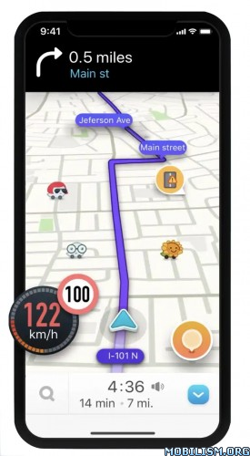
– Live routing based on community driven, real-time traffic & road info
– Community reported alerts including accidents, hazards, police traps, road closures, and more
– Turn-by-turn voice guided navigation
– Live maps, consistently edited and updated by Waze community map editors
– Automatic rerouting as conditions change on the road
– Send your ETA & real-time drive to update those you’re meeting
– Learns your frequent destinations, commuting hours, and preferred routes
– Find the cheapest gas station on your route
– Add information on local places and businesses
– Add Facebook friends and sync Contacts
– See friends’ ETA when driving to the same destination
– One tap navigation to Facebook & Calendar events
– Earn points as you contribute road info and climb the ranks in your community

Waze is all about contributing to and benefiting from the common good, so hop on board and get involved!

Note: Continued use of GPS running in the background can dramatically decrease battery life. Waze will automatically shut down if you run it in the background and haven’t driven for a while.

Learn more about the Waze privacy policy, including what information is accessed and how it is used. With Waze, you have full control over your privacy settings. _http://www.waze.com/legal/privacy/

MOD features:
Decensored Waze version with the following improvements compared to the official version:
– display of the exact location of fixed or mobile speed cameras.
– enlarged speed limit sign for more readability
– Radar sound alert whatever the speed (only in case of speeding with the official version)
– personalized card skin with black background to save battery and improve readability
– Choice of new voices compared to the official version
– Vanessa (unmodified),
– Morgan (Cars voice is pretty cool), if you prefer Morgan’s real voice, delete the folder in waze / sound / french
– Svenska (French voice, sound boosted),
– Srpski (star wars voice the 1st voice after the English voices).
– transparent gray signal button (instead of a solid orange circle in the official version) for more map readability and to avoid the "burn" effect on the AMOLED screen
– possibility to report bad or no limitation by clicking on the speedometer then choose "report" (option absent in official version)
– announcement distance of the modified controls compared to the official version:
– highway at 1500 m
– Fast lanes at 1200 m
– Roads at 1000 m

NB; distance configurable in the "Preferences" file by adjusting these 2 lines:
Alerts.Alert Distanc_: 1000
Alerts.Police Alert Distac_: 1000

Speed ​​camera warnings have been officially banned in France since January 2012, their use is punishable by a fine of 1,500 euros and a withdrawal of 6 points on the driving license.

By installing this version, you remain responsible for its use.
Namely in France according to the law still in force to this day: The police do not have the right to search your smartphone.

What’s New:
New Beta release v.4.85.0.0. Please visit Centercode for full release notes and to submit your feedback.

Fixed:
– ETA bar constantly showing "Connecting" after restored from offline
– Loading wheel hangs too long in the ETA bar after route is built
– Crash fixes

This app has banner and credit advertisements

More Info:
https://play.google.com/store/apps/details?id=com.waze&hl=en

Download Instructions:
https://ouo.io/43ysxQ

Mirrors:
https://rapidgator.net/file/6ecb319678f … e.apk.html
https://ouo.io/2e9aUB
Download Recce – Planning & Orienting v2.2.1 [Paid]

Recce – Planning & Orienting v2.2.1 [Paid]
Requirements: 5.0 and up
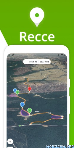
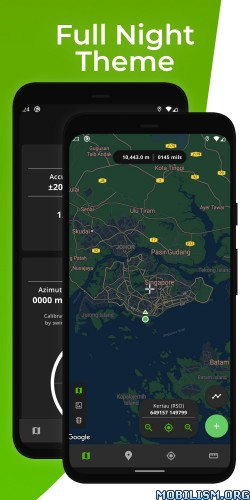
Overview: Navigational and Map Planning app with multiple coordinate systems support. A handheld GPS and calculator in one app. Built with the Maps SDK and Fused Location API for high accuracy and low power consumption, suitable for long expeditions.

Image Image

A handheld GPS and calculator in one app. Built with the Maps SDK and Fused Location API for high accuracy and low power consumption, suitable for long expeditions.

Features:

Map

• Instantaneous coordinates and grids update.
• Pins: Mark points on map and save them.
• Routes: Plot lines and place checkpoints to mark a Route.
• Areas: Join the ends of a Route to demarcate an Area.
• Geodesic distance: Lines drawn on the map are geodesic and show the shortest path between 2 points on the Earth’s surface.

Pins (or Markers)

• Organise and classify saved items through groups and colors.
• Manage saved Pins, Routes, and Areas by sorting and deleting.
• Add multiple Pins to the Ruler sequentially.

GPS

• Provides your current location using the Fused Location API for higher accuracy at lower power consumption.
• Provides your bearing using your device’s position sensors
• Graphical compass for navigation and wayfinding with support for any orientation/rotation.

Ruler

• Measures distances and bearing between Pins.
• Supports multiple Pin additions for cumulative measurements.
• Add Routes and Areas to measure distances and straight-line direction between each checkpoint.

Coordinate Systems:

Recce supports the following systems:
1. WGS84 Latitude & Longitude
2. UTM, all Zones
3. MGRS (in UTM coverage only)
4. Kertau (RSO) / RSO Malaya (m)

Note 1: The app abides by the Area of Use of each system and returns "N/A" in locations outside the system’s bounds.
Note 2: The app does not support UPS (universal polar stereographic) and there is no plan to.

Disclaimer:

Recce is NOT affiliated with any military organizations or armed forces. All formulas and information in the app are obtained from freely available sources such as the EPSG repository and guide.

★ Untouched Paid apk with Original Hash Signature
★ Certificate MD5 digest: 9b87467d63e0ebfecd830dd2b761adc9
★ No changes were applied
➡ Languages: Full Multi Languages
➡ CPU architectures: Universal
➡ Screen DPIs: 120dpi, 160dpi, 240dpi, 320dpi, 480dpi, 640dpi

What’s New:
v2.2.1

New features:
1. Imperial units and nautical miles for distances and areas

Bug fixes:
1. Fixed parsing of UTM coordinates with 7-digit northings.

This app has no advertisements

More Info:
https://play.google.com/store/apps/details?id=com.nujiak.recce&hl=en

Download Instructions:
https://ouo.io/2iqpkT

Mirrors:
https://rapidgator.net/file/4486d94b67b … 8.apk.html
https://ouo.io/hLJrz9

Download Detecht – Motorcycle App & GPS v3.7.7 [Premium]

Detecht – Motorcycle App & GPS v3.7.7 [Premium]
Requirements: 6.0+
Overview: Motorcycle GPS app for tracking, planning and exploring new motorcycle routes

Image

Everything you need for your upcoming motorcycle trip. The Motorcycle App that automatically detects accidents and sends an alarm to you Emergency Contacts with the accidents time and position. No more expensive GPS hardware needed, use Detecht for easy and accurate tracking and navigation. Add your motorcycle, bike accessories and connect with other bikers. Plan upcoming motorcycle trips, add multiply waypoints, choose between different roads between two waypoints and add your planned gas stops along the way. Plan and track your motorcycle rides in an app developed only for bikers and give your loved ones peace of mind!

Detecht Features – everything you need for your motorcycle rides!

Crash Detection

The app detects accidents through analyzing driving data and changes in the smartphone’s accelerometer, gyroscope, magnetometer and GPS. As a motorcyclist you deserve to feel safe while riding, the same goes for your loved ones!

Emergency Contacts

Choose your personal Emergency Contacts. They will automatically get an emergency text message with your name and exact location in case of an accident. They can in turn alarm authorities and keep you safe.

Track, Navigate and Save Routes

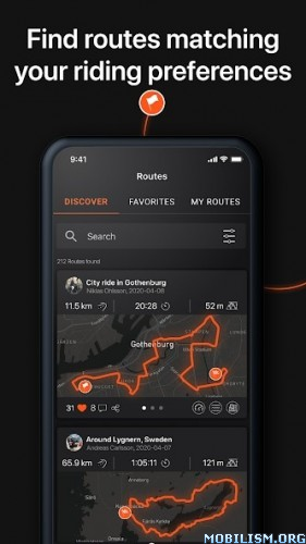
Plan and track your routes and add as many stops and POIs as you like. Ride with our turn-by-turn navigation or voice guidance. Create personal routes that you can save and share to our motorcycle community, on social media or among friends. Discover amazing new routes through the Explore Routes feed! Favorite mark routes to save them and ride them later on, while Detecht’s alarm features keep you safe during the ride.

Driving Statistics

With Detecht’s Safety and GPS navigation app you will be able to go back and see your driving data. You will get driving statistics on a weekly, monthly and yearly basis to be able to compare from year to year, month to month etc. Compare distance, speed and time with the motorcycle community and your friends.

Profile

Create and customize your profile. Upload images of your motorbike and important information about your bike(s) such as brand, model, model year, cc and distance.

Social

Experience our motorcycle community where you can get in contact with like minded riders from all over the world. Find new friends or add your current riding friends and start a conversation with our in-app chat.

Background tracking

Some phone models have problems running the GPS in the background, which is important for the automatic emergency alarm and GPS Tracking to work. This is due the phone manufacturers hard battery regulations, turn of battery optimization and then allow Detecht to work in the background will usually solve these problems. This applies, for example, to some models from OnePlus, Huawei and Samsung. Visit https://dontkillmyapp.com for more information and solutions. Otherwise, reach out to us at: feedback@detecht.se and we will help you solve it.

Subscriptions

Detecht offer one premium subscription with three different periods, 1 month, 6 months and 12 months. The subscriptions include full access to Turn-by-turn navigation, Safety Tracking, up to 5 Emergency Contacts, GPX Export and some new upcoming features!

Terms of use: https://detechtapp.com/terms-of-use

What’s New:
New Premium Feature – Curvy Roads:

Plan new adventures with the curvy roads option!

New Feature – Auto-Pause:

No more unintentional tracking during your breaks. Auto-pause is here to have your tracked rides resembling the actual route.

New Feature – Sharing Planned Route:

You can now share a planned route to your friends directly in the app!

This app has no advertisements

More Info:
https://play.google.com/store/apps/details?id=se.app.detecht

Download Instructions:
https://ouo.io/YWq9nU

Mirror:

https://ouo.io/kp6pb2

Download Compass and GPS tools v26.0.6 [Premium] [Mod Extra]

Compass and GPS tools v26.0.6 [Premium] [Mod Extra]
Requirements: 8.0+
Overview: Do you keep waiting long for GPS location when you open your favorite app like say Maps ?

ImageImage

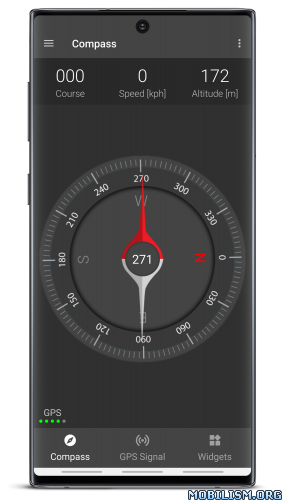
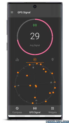
• Compass – Magnetic Heading
• Navigation stats – Speed, Course, Altitude, Latitude and Longitude
• Satellite stats – Signal, Almanac, Ephemeris, Azimuth, Time and Fix Accuracy
• Keepalive – Keep GPS locked awake

Premium Features(Inapp Purchase):
• Adfree
• Keepalive widget

Technical Note:
It takes at least 3 to 4 satellites before you can receive location fix. Almanac(Imprecise) and Ephemeris(Precise) are satellite data cached in the GPS engine. The almanac data validity is in months. The ephemeris data gets invalidated in a few hours. If you get more satellites with valid ephemeris then you will quickly get location fixes with good accuracy.

What’s New:
• Bug fixes

Mod Info:

  • Premium / Paid features unlocked;
  • Disabled / Removed unwanted Permissions + Receivers + Providers + Services;
  • Optimized and zipaligned graphics and cleaned resources for fast load;
  • Ads Permissions / Services / Providers removed from Android.manifest;
  • Ads links removed and invokes methods nullified;
  • Ads layouts visibility disabled;
  • Google Play Store install package check disabled;
  • Debug code removed;
  • Remove default .source tags name of the corresponding java files;
  • Analytics / Crashlytics / Firebase disabled;
  • No active trackers or advertisements;
  • Languages: Full Multi Languages;
  • CPUs: universal architecture;
  • Screen DPIs: 160dpi, 240dpi, 320dpi, 480dpi, 640dpi;
  • Original package signature changed;
  • Release by Balatan.

This app has no advertisements

More Info:
https://play.google.com/store/apps/details?id=com.cls.gpswidget

Download Instructions:
https://ouo.io/CXKNkI

Mirrors:
https://ouo.io/jsXcUo
https://ouo.io/Yf5lGR
https://ouo.io/pp3jzb
https://ouo.io/XYZ55d
https://ouo.io/zDn0u1
https://ouo.io/M1n2B9

Download bergfex/Tours Hiking & Biking v4.0.19 [Pro]

bergfex/Tours Hiking & Biking v4.0.19 [Pro]
Requirements: 8.0+
Overview: The perfect ALL-IN-ONE tool for all your outdoor activities. Use it for Hiking, Mountain Biking, Running, Cycling, Climbing, Nordic walking, Ski Tours, Fitness and much more.

Image

Outdoor Tracking & Tours App
The perfect ALL-IN-ONE tool for all your outdoor activities. Use it for Hiking, Mountain Biking, Running, Cycling, Climbing, Nordic walking, Ski Tours, Fitness and much more.
Your Tool for tracking and planing your tours:
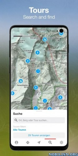
● detailed topographical maps for Europe
● more than 70.000 GPS-Tours
● great search functionality
● offline maps (PRO-Version)
● tool for planning your personal tours
● connectivity for bluetooth watches or chest straps
● websync with myBergfex account
● save your favourite tours
● GPX export/import

• Use the Tours App as a activity or fitness tracker (with pulse recording function and pulse zones in pro version).
• Choose one of more than 70.000 detailed hiking tours, mountainbike tours, running courses, ski tours, cycling routes and much more – inform yourself about length, height, duration, etc. to get a detailed description with photos of the tour (if you are going to hike or ride a selected tour you can use our way-leaving-function to get a warning if you once missed the right way).
• Download your maps offline on your smartphone (PRO Version) so you will not need a mobile or internet connection for navigation any more.
• Plan your personal tour from any start point to your preferred top of the mountain (this is also possible with different waypoints – in PRO Version).
• All your activities and tours-favourites are synced with your (optional) myBergfex account and you will have a backup and synced tours across all your devices.
• With the favourite functionality you have easy access to your most liked tours.

PRO-Features:
You can use all PRO-Features for one week for free!
● detailed topographical maps for Europe (with higher zoom levels)
● slope steepness overlay (to display the steepness >30°,35°,40°,45°)
● ÖK50 (detailed Austrian Mountain Map)
● offline maps (for navigation with no mobile or internet connection)
● sat-view overlay function (with additional information in the maps)
● routing function with waypoints
● pulse measurement with zones
● no advertising in PRO-Version

The Bergfex Tours App is your perfect partner for all your outdoor activities (Mountain Biking, Running, Cycling, Climbing, Nordic Walking, Ski Tours, Fitness and much more).

Note: Continued use of GPS running in the background can dramatically decrease battery life.

Terms and Conditions: http://www.bergfex.at/agb/
Privacy Policy: http://www.bergfex.at/datenschutz/

What’s New:
All areas of the app revised
Improved usability
Tracking and altitude measurement improved
New functionalities

This app has no advertisements

More Info:
https://play.google.com/store/apps/details?id=com.bergfex.tour

Download Instructions:
https://ouo.io/4mGkGwk

Mirror:
https://ouo.io/zyNxJL