ContraCam – Speed Cameras, HUD v3.5.00 [Premium]
Requirements: 4.0.3+
Overview: Save money on fines, save money on mobile internet, save disk space on a device. GPS Radar & road camera detector.
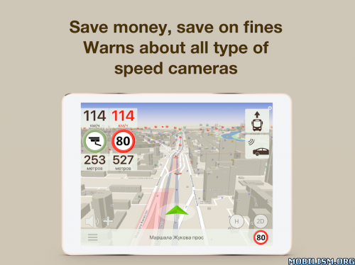
Save money on fines, save money on mobile internet, save disk space on a device. GPS Radar & road camera detector. Warns of all types of speed cameras, road hazards, fixed radars, traffic police posts and other dangerous road objects.
Radar detector
• free cameras and maps updates. No any subscriptions.
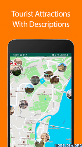
• a detailed map of the speed cameras, road hazards and points of interest.
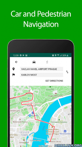
• very quick offline 3D maps, HUD way mode.
• daily updates cameras and road hazards.
• information about the cameras and road hazards moderates by specialists.
• updates the cameras and road hazards base automatically. It is not necessary to monitor the latest data, ContraCam finds and downloads updates automatically.
• updates cameras and road hazards on the fly. The database of cameras and road hazards is so compact that allows to receive the latest information even through low-quality mobile Internet.
• warns about back-shot cameras, a pair of average speed check cameras, dummy cameras and other types of cameras that are not visible for the usual radar detectors.
• the ability to choose the types of cameras and road hazards.
• captures and controls several potentially dangerous objects.
• voice and sound alerts.
• works in the background with other applications. Compatibility with turn-by-turn navigators.
• warns of traffic calming, crossroad, crosswalk, traffic lights, road signs.
Attention! The application as radar detector works only in following countries:
• Russia
• Azerbaijan
• Armenia
• Belarus
• Kazakhstan
• Kyrgyzstan
• Latvia
• Lithuania
• Moldova
• Turkmenistan
• Uzbekistan
Navigation
• specially created offline 2D and 3D maps, high-performance, doesn’t require Internet and doesn’t take much disk space.
• convenient control of maps and objects on them.
• day and night modes.
• the ability to work with all regions and countries simultaneously.
• road track and bookmarks.
• data collections and folders.
• export GPX, KML, CSV.
• a general map of the world.
• shows the speed limits of the road.
• a points of interest.
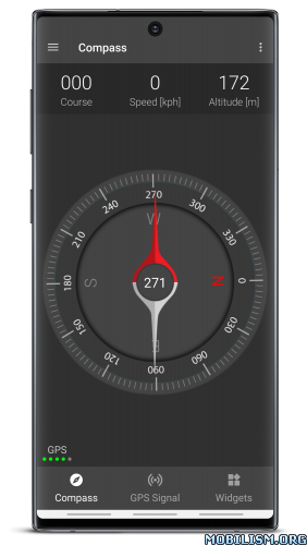
Speedometer
• warn about restriction on road
• show road restrictions
• user defined restrictions for city and highway
Disclaimer: The use of a speed camera warning device may not be legal in all countries and territories. Please follow the traffic rules!
Download the app and save on fines today!
Many thanks to everyone who wrote to us and supported the project! If you like the app, please leave a review in the Google Play.
Enjoy the use safe driving.
Attention! Continued use of GPS running in the background can dramatically decrease battery life.
What’s New:
• warn about switch road restrictions
• warn about only unusual road restrictions
• bug fixing
This app has no advertisements
More Info:
https://play.google.com/store/apps/details?id=com.mybedy.antiradar&hl=en
Download Instructions: credit alex.strannik
armeabi-v7a:
https://ouo.io/dkZF0Sh
Mirrors:
https://ouo.io/a4Qzau
https://ouo.io/ZI44gN
https://ouo.io/dJK6p9
arm64-v8a:
https://ouo.io/oGTIA0
Mirrors:
https://ouo.io/eY2BZU
https://ouo.io/SuRtZs6
https://ouo.io/22uNWI