GPS AntiRadar (radar detector) v35.0 [Pro]
Requirements: 5.0+ | RU
Overview: GPS Anti-Radar works as a radar detector and warns you about fixed cameras (speed cameras) and DPS radars on your way.
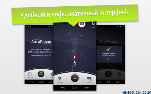
GPS Anti-Radar works as a radar detector and warns you about fixed cameras (speed cameras) and DPS radars on your way. If, when approaching the camera, your speed will be higher than the resolution of more than 19 km / h, the application will give warning sounds. And this is important, because now the penalty for exceeding 20 km / h already starts from 500 rubles.
Map with cameras in our database – map.gpsantiradar.info
Our group VKontakte – vk.com/smartdriver.blog
The official Facebook page is facebook.com/Antiradar
Here you can leave your wishes, comments, information about missing cameras, etc.
*** Good news! *** Now there is a free version of GPS AntiRadar. You can evaluate and test the program in your city absolutely free of charge – http://goo.gl/u7Z7AJ
The application works with the help of well-known data on the location of fixed cameras and DPS radars (such as Strelka or Start ST) and other objects. It is possible to add the missing cameras manually and synchronize them between users! You do not need to wait until we add cameras, it is replenished simply and conveniently by the users themselves!
This radar detector, of course, works more reliably, but also costs more than 100 times more expensive than this application.
GPS AntiRadar can work in the background, i.e. You can use it in conjunction with the navigator. Messages about cameras or traffic police posts will be displayed using voice notifications.
Attention! GPS AntiRadar is your assistant, but not a guarantee of the absence of fines, because New cameras may not immediately enter the database. Please follow the rules of the road.
Currently, the application contains a map of cameras and radars for:
– Russia, Kazakhstan, Belarus and Ukraine
––––––––––––
Frequently Asked Questions:
1. The application can not find the GPS signal. What to do?
GPS operation depends on many factors, including the weather. Many programs, such as navigation, use, besides GPS, GSM, triangulation over cellular towers (we do not use it in view of the large error).
– Go out into the open space. The GPS signal will not be found in the apartment or other enclosed area.
– Make sure the GPS module is turned on. When you turn on GPS AntiRadar, a system notification about GPS operation should appear in the Android event panel.
– Try to turn off and re-enable the GPS module.
2. There is no sound notification. What to do?
– Make sure that the volume of all types of notifications is set to maximum. You can find this setting in the following way: open the standard Android settings -> Sound -> Volume.
– Make sure that GPS is not set to speed only checkbox. This will allow you to play the sound without violating traffic rules.
– Check the work by driving near the camera. As soon as the camera type appears on the screen and the speed limit of this camera should beep.
– When you connect your device to the car’s car stereo using Bluetooth, make sure that other applications can play audio notifications.
3. I used to use the free version and then bought Premium, but the application has not changed / I cannot install the Premium version
– Remove all previous versions and re-install Premium with GooglePlay at https://play.google.com/store/apps/details?id=air.StrelkaSD.
4. Removed money twice. Why?
– This is a feature of Google Play, as a rule, they return the money themselves on the same day, without additional actions. Our application does not deal with any operations with money.
5. For the application to work in the background on devices Xiaomi, Huawei and Meizu, you need to configure the devices. See our instructions:
– Xiaomi: http://airbits.ru/background/xiaomi.htm
– Meizu: http://airbits.ru/background/meizu.htm
– Huawei: http://airbits.ru/background/huawei.htm
– Common to all devices: http://airbits.ru/background/background.htm
What’s New:
Friends, thanks for the feedback. We are working on the project, making improvements. For any questions, write to us: gpsantiradar@gmail.com
• Added section System Permissions, which lists the necessary permissions for the correct operation of the application;
• Updated various libraries under the hood of the application.
Follow our news:
http://radarbase.info/news
This app has no advertisements
More Info:https://play.google.com/store/apps/details?id=air.StrelkaSD&hl=en
Download Instructions: credit viktorovich31
https://ouo.io/PtkywUM
Mirrors:
https://ouo.io/p2fNZK
https://ouo.io/RpmHVq9
https://ouo.io/aKyqh1C