All-In-One Offline Maps + v3.5b build 89 [Paid]
Requirements: 3.0+
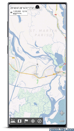
Overview: All-In-One OfflineMaps+ offers you to access a wide range of maps.
Bored to wait for maps to display? Use All-In-One OfflineMaps! Once displayed, maps are stored and remain available, quickly, even with no network access.
• Want more than just roads on your maps? You will find what you need here;
• Used to go to places with poor network coverage? Everything will stay available;
• Used to go abroad? You won’t be lost anymore;
• Have a data allowance limit? It will reduce your usage.
This Plus version includes all features of the Standard version without ads, and supports import of professional GPS and geographic landmarks file formats (waypoints, routes, tracks, areas) like GPX, Google Earth KML/KMZ (map overlays not supported), OziExplorer© WPT/PLT, CVS/TSV and Geocaching LOC
★★ Maps ★★
A lot of maps are available, including classical road maps, topographic maps, aerial (satellite) maps and various layers that can be added over any maps: OpenStreetMap (Roads, Topo), USGS National Map (Hi-res topo, Aerial imagery), Worldwide Military Soviet topo maps, etc.
• All maps can be stacked in layers, with precise opacity control;
• Select and store large areas in few clicks;
• Stored space is clear and can be easily deleted.
★★ Display, store and retrieve unlimited landmarks ★★
You can add various items on the map such as waypoints, icons, routes, areas and tracks.
You can easily manage them using the powerful SD-Card Landmarks Explorer.
★★ On-map GPS Location & Orientation ★★
Your real location and direction are clearly displayed on the map, which can be rotated to match your real orientation (depends on device capabilities).
Easy turn on/off to save battery.
And also:
• Metric, imperial and hybrid distance units;
• GPS Latitude/Longitude and grid coordinate formats (UTM, MGRS, USNG, OSGB Grid, Irish Grid, Swiss Grid, Lambert Grids, DFCI Grid, QTH Maidenhead Locator System, …);
• Ability to import hundreds of coordinate formats from http://www.spatialreference.org;
• On-map grids display;
• Full screen map view;
• Multi-touch zoom;
• …
★★ Need more? ★★
If you are a real adventurer, try AlpineQuest Off-Road Explorer, the complete outdoor solution based on All-In-One OfflineMaps, loaded with a powerful GPS Location Tracker and more: http://www.alpinequest.net/google-play
What’s New:
• Added ability to display a circular scale over the map (Main menu → Options → Display circular scale);
• Added ability to display and compute bearings relative to the magnetic north;
• New in-app purchase: added ability to calibrate images in order to use them as maps (just open an image with the Maps Explorer) (.jpg/.png/.bmp/.gif);
• New in-app purchase: added support of OziExplorer maps using images (.map+.png/.jpg/.bmp/.gif);
• Various improvements and bug fixes.
This app has no advertisements
More Info:https://play.google.com/store/apps/details?id=net.psyberia.offlinemapsplus
Download Instructions:
http://gestyy.com/w8z65u
Mirrors:
http://gestyy.com/w8z65s
http://gestyy.com/w8z65j
http://gestyy.com/w8z65c
