Download OsmAnd+ — Maps & GPS Offline v4.9.2 [OsmAnd Live] [Mod Extra]

OsmAnd+ — Maps & GPS Offline v4.9.2 [OsmAnd Live] [Mod Extra]
Requirements: 7.0+
Overview: Osmand is opensource navigation application with raster/vector maps
ImageImage

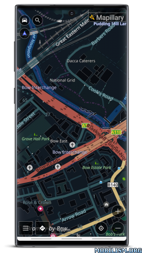
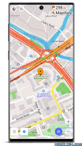
Osmand+ is an open source navigation application with access to a wide variety of global open street map data. All map data (vector or tile maps) can be stored on the phone memory card for offline usage. Osmand also offers offline and online routing functionality including voice guidance.
Osmand+ is the paid application version, by buying it you support the project, fund the development of new features, and receive the latest updates.
Some of the core features:
– Complete offline functionality (store downloaded vector or tile maps in a selectable folder)
– Compact offline vector maps for the whole world available
– Unlimited downloading of country or region maps directly from the app
– Offline Wikipedia feature (download Wikipedia POIs), great for sightseeing
– Overlay of several map layers possible, like GPX or navigation tracks, Points of Interest, favorites, contour lines, public transportation stops, additional maps with customizable transparency
– Offline search for addresses and places (POIs)
– Offline routing for short distances (experimental)
– Car, bicycle, and pedestrian modes with:
– Optional automated day/night view switching
– Optional speed-dependent map zooming
– Optional map alignment according to compass or direction of motion

What’s new
• Added a full-screen gallery viewer for Wikimedia images
• Introduced a new plugin "Vehicle Metrics" to monitor vehicle performance using the OBD-II protocol
• Added the ability to assign activities to tracks and filter them accordingly
• Implemented new quick actions for trip recording and touchscreen lock
• Introduced customizable map button appearance and a precise grid
• Added a context menu and a "Reset average speed" action to widgets
• Added new route layer "Dirt Bike trails"

Mod Info:
  • OsmAnd Live / Paid features unlocked;
  • Disabled / Removed unwanted Permissions + Receivers + Providers + Services;
  • Optimized and zipaligned graphics and cleaned resources for fast load;
  • Debug code removed;
  • Analytics disabled;
  • AOSP compatible mode;
  • Languages: Full Multi Languages;
  • CPUs: armeabi-v7a, arm64-v8a, x86, x86_64;
  • Screen DPIs: 160dpi, 240dpi, 320dpi, 480dpi, 640dpi;
  • Original package signature changed;
  • Release by Balatan.


This app has no advertisements

More Info:

Download FLY is FUN Aviation Navigation v33.72 [Unlimited]

FLY is FUN Aviation Navigation v33.72 [Unlimited]
Requirements: 5.0+
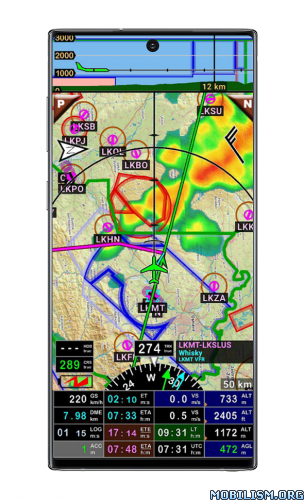
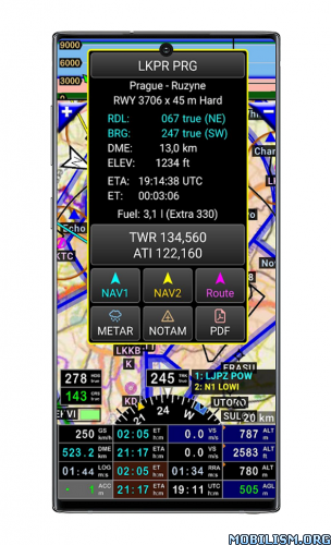
Overview: FLY is FUN is designed by pilots for pilots. FLY is FUN simplify flight preparation and improve situation awareness during flight, providing information on airspaces, reporting points, position on moving map, elevation, frequencies, railway, weather info … facilitate access to airfields related PDF document. Application also displays NOTAMs and data from rainfall radars.

ImageImage

FLY is FUN is designed by pilots for pilots. FLY is FUN simplify flight preparation and improve situation awareness during flight, providing information on airspaces, reporting points, position on moving map, elevation, frequencies, railway, weather info … facilitate access to airfields related PDF document. Application also displays NOTAMs and data from rainfall radars.

FLY is FUN simulates ILS approach, VOR, NDB, DME, Marker beacons, RNAV navigation and Marker beacons warnings, without ILS/VOR/NDB/RNAV equipment on board.

You can test FLY is FUN for free during few days. At the end of the trial period, pilot is invited to subscribe and pay an annual fees. Doing it, he get the right of using the application "as it is" and contribute to development effort.

FLY is FUN allows:
– Creating and modifying routes using "drag and drop", "rubber band"
– Getting warnings, alarms and radio info before entering controlled or special use airspaces, approaching points
– Performing route planning, evaluating distance, time and fuel consumption (depending on wind and aircraft characteristics)
– Displaying route, bearing, trace on moving map
– Visualizing airspace
– Getting dynamic terrain map (colors depending of elevation above ground level)
– STRATUX support
– Creating and exporting Flight Plan
– Creating and exporting Flight log
– Creating, importing or exporting routes, waypoints, RWY, airspace (Garmin .gpx, .kml, txt, OpenAir)
– Recording the flight and playing it back with Google Earth
– Sunset / Sunrise
– Getting weather forecast along the route
– Rainfall radar
– Wind displaying
– Calculating distance between 2 points on the map
– VACs
– Notepad


All main screens (5 portrait and 5 landscape could easily be customized. Pilot can choose from around 100 values to display. Example:
– Altitude GPS or barometric
– Ground speed
– Bearing
– Vertical speed
– DME to next point / destination
– Estimated time to next point / destination
– Time since departure
– Stop watch


Displayed information could be customized too depending of users preferences (VFR, IFR or both) and zoom level. The more you zoom IN, the more detail, information, waypoints,.. you see

Logbook
The integrated logbook, allows recording:
– Duration since departure time
– Departure and arrival time
– Departure and arrival airport
– Flight track (it is possible to export it as .kml or .gpx and to replay it)
– Used aircraft
– Pilot(s) and copilots in charge
– Distance, average speed, maximum speed


Navigation data available from open source database are updated according AIRAC cycles.

Charts and elevation dta
Free charts and elevation data are available for most of countries and could be imported directly via the application store.
Other charts could be created and imported by the pilot itself or made on request available as commercial service.

Pilots could select the most appropriate charts: free open source charts as well as commercial charts as ICAO, Cartabossy, SkyVector, FAA sectional and terminal charts…

VACs and PDF files
VAC and AIP infos are available for more than 50 countries
User can easily attach your own PDF files.

Usage of external GPS connected via Bluetooth is possible

User guide: _http://www.funair.cz/downloads/manuals/flyisfun.pdf

If you have any suggestion to improve this application or you find some bug please visit _http://www.flyisfun.com

Use this application for VFR FLYING ONLY!!! We are not responsible for any use of this application.

What’s New:
Removed bug: When app uses the external data (GDL90, …) the The ACC window could display nonsensical values.

This app has no advertisements

More Info:
Code: Select allhttps://play.google.com/store/apps/details?id=gps.ils.vor.glasscockpit&hl=en

Download Instructions: credit maxi123444
https://ouo.io/769dOy

Mirrors:
https://ouo.io/K6t01J
https://ouo.io/HfZLeK

Trouble downloading? Read This.

Download Speedometer: GPS Speedometer v1.1.5 [Mod Ad-free]

Speedometer: GPS Speedometer v1.1.5 [Mod Ad-free]
Requirements: 6.0 and up
Overview: GPS Speedometer & Odometer is the most accurate speed tracker which measures the speed of any kind of transportation. Our accurate and reliable speed limit alert is ready to notify you once you are beyond the limit. Digital or Analog mode can display your current speed and distance on different scales.


Image

With easy-to-use HUD mode, this powerful speed tracker will show your speed in digits like a real car speedometer. For various vehicles like bicycle, motorcycle and taxi car, it can help you check velocity easily and track your current location accurately even when offline. You can switch between different speed units in kilometer per hour (km/h), miles per hour (mph), and knot.

This highly precise speedometer app can measure how fast you are while driving, jogging and running. GPS navigation enables you to see your real-time location fast and keeps track of every journey route on map intuitively.

The fantastic features you can get:
GPS Speedometer & Odometer provides a simple and attractive UI so you can check your speed and other stats at a glance
Work offline. GPS Speedometer can work quickly even if the internet connection is poor
Digital GPS Speedometer odometer features a map recording your trail and you can enable/disable tracking on map according to your need
Digital speed tracker is perfect for measuring the velocity of every circumstance like cycling, driving, walking and jogging, and more via GPS navigation
Set a speed limit with ultimate GPS speedometer. You will be notified with vibration, voice alert and dangerous alarm when you exceed the limit
Head up display (HUD) mode mirrors instant speed on your car’s windshield
Speedometer app keeps track of your trail with detail & accurately, like real-time speed, average speed, maximum speed, mileage, starting and ending point
Switch freely between three speed units in kilometer per hour(km/h), mph miles per hour(mph), and knot
Speed tracker GPS app offers both portrait and landscape modes to suit your needs
Simple and practical widgets and support display in the notification bar
Pause or reset anytime during your route
Distance tracker app keeps track of your history of travel with detailed information, never miss any of your historical routes
GPS speedometer and odometer offers multiple beautiful theme colors for you to choose
Small in size and battery-friendly
Display the digital speedometer as a small window over other apps to use it with navigation apps
Getting your instant speed and distance & ensure your safety along the way just needs one download

Get the most out of GPS Speedometer if you:
– Desire to test your speed while walking, jogging, cycling, driving, flying and sailing, etc.
– Want to track your daily mileage
– Favor a simple and fantastic speed tracker app to measure how fast you are going anytime
– Wish to replace your broken or inaccurate car speedometer

Use GPS Speedometer to track:
Speed: track real-time speed, average speed and maximum speed
Time: record your trip time
Location: locate your starting and ending point and show your trail
Distance: record your distance

Don’t hesitate anymore! Try this helpful and accurate digital speedometer app at no cost! It can work offline and easily measure how fast you are on the bike, motorcycle, car, bus, train, etc.

No matter whether you want to measure your speed & distance or track your location, our fantastic GPS Speedometer & Odometer is always here to help.

What’s New:
no changelog

This app has no advertisements

More Info:
Code: Select allhttps://play.google.com/store/apps/details?id=gps.speedometer.gpsspeedometer.odometer

Download Instructions: Credit to Maximoff
https://ouo.io/J4HJgj

mirrors:
https://ouo.io/fuyoBND
https://ouo.io/A9W2rM

Trouble downloading? Read This.

Download Lunescope Pro: Moon Phases+ v12.2 [Paid] [Patched]

Lunescope Pro: Moon Phases+ v12.2 [Paid] [Patched]
Requirements: 5.0+
Overview: Spectacular, interactive 3D simulation of the moon, right down to the shadows in the craters and earthshine on the dark side. Touch screen control changes date and time as seen from your location – the phase tracks your every move. Use two fingers to spin the moon itself (see the far side!) and zoom in to see lunar features up close.

Image

Featured by:
★ Google Play Editor’s Choice, Stellar apps for stargazers & space explorers
★ Yahoo! News, Best Stargazing Apps
★ Appolicious, Best Moon Phase Android Apps

Lunescope has features you’ll find in no other moon app, including:
▶ For any date/location, instantly shows phase, crescent angle, libration, rise/set times, and nearest syzygies
▶ Zoom in for a detailed lunar map (up to 2500x magnification) with details on all surface features
▶ Shows supermoons, blue moons, and black moons
▶ Displays all lunar eclipses, with exclusive visualization
▶ Change phase by touchscreen or direct date entry
▶ 2 finger drag rotates the 3D moon simulation
▶ Choice of imagery: High definition or Maximum realism (includes dynamic shadows of craters, mountains, etc.)
▶ Lunar Calendar shows month’s phases at a glance
▶ Data pane gives additional details: azimuth, altitude, distance, apogee, perigee, zenith, and more
▶ Astronomer options make Lunescope the perfect companion to your telescope
▶ Configurable notifications for phases, eclipses, and more
▶ Live wallpaper
▶ Resizable home screen widget, with optional moon info text
▶ Wear OS watch face shows the same imagery, plus (optionally) abbreviated data
▶ Supplies moon data and imagery via complications to other Wear OS watch faces
▶ Also includes a Wear OS Tile to show moon phase and data alongside your existing watch face
▶ Fully optimized for Chromebooks and tablets

[Formerly Moon Phase Pro – it’s more than just a phase!]

What’s New:
• Fix bug with May 26 eclipse

This app has no advertisements

More Info:
Code: Select allhttps://play.google.com/store/apps/details?id=com.daylightmap.moon.pro.android

Download Instructions:
https://ouo.io/j3xov5

Mirror:
https://ouo.io/HkqqEz

Trouble downloading? Read This.

Download PeakFinder v4.8.30 [Paid] [Patched] [Mod Extra]

PeakFinder v4.8.30 [Paid] [Patched] [Mod Extra]
Requirements: 5.1+
Overview: The mountains are calling! Explore more mountains than any mountaineer! PeakFinder AR makes it possible… and shows the names of all mountains and peaks with a 360° panorama display.

Image

This functions completely offline – and worldwide!
PeakFinder knows more than 650’000 peaks – from Mount Everest to the little hill around the corner.

•••••••••
Winner of several prizes. Highly recommended by nationalgeographic.com, androidpit.com, smokinapps.com, outdoor-magazin.com, themetaq.com, digital-geography.com, …
•••••••••

••• Features •••
• Works offline and worldwide
• Includes more than 650’000 peak names
• Overlays the camera image with the panorama drawing *
• Realtime rendering of the surrounding landscapes in a range of 300km/200mil
• Digital telescope to select less prominent peaks
• ‘Show me’-function for visible peaks
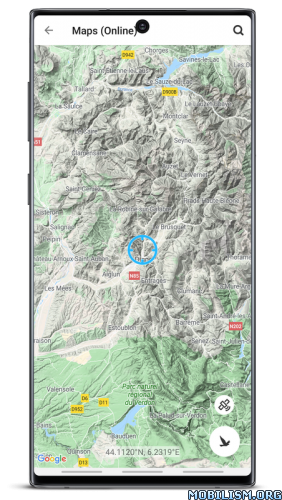
• Selection of the viewpoint by GPS, the peak directory or an (online) map
• Can fly like a bird from peak to peak and vertically upwards
• Shows the solar and lunar orbit with rise and set times
• Uses compass and motion sensors
• Weekly updates of the peak directory
* On devices without a gyroscope and a compass sensor the camera mode is not supported.

What’s New:
Smaller optimizations and bug fixes.

Mod Info:
  • No root or Lucky Patcher or Google Play Modded required;
  • Disabled / Removed unwanted Permissions + Receivers + Providers + Services;
  • Optimized and zipaligned graphics and cleaned resources for fast load;
  • Google Maps Locations works;
  • Google Play Store install package check disabled;
  • Debug code removed;
  • Remove default .source tags name of the corresponding java files;
  • Analytics / Crashlytics / Firebase disabled;
  • Languages: Full Multi Languages;
  • CPUs: armeabi-v7a, arm64-v8a, x86, x86_64;
  • Screen DPIs: 160dpi, 240dpi, 320dpi, 480dpi, 640dpi;
  • Original package signature changed;
  • Release by Balatan.


This app has no advertisements

More Info:
Code: Select allhttps://play.google.com/store/apps/details?id=org.peakfinder.area.alps

Download Instructions:
https://ouo.io/StJT3E

Mirrors:
https://ouo.io/B1ZKYB
https://ouo.io/vCsxQQY
https://ouo.io/GrYlaC
https://ouo.io/ky14Pf
https://ouo.io/jnzshl

Trouble downloading? Read This.