Download Waze Navigation & Live Traffic v4.101.0.1 RC

Waze Navigation & Live Traffic v4.101.0.1 RC
Requirements: 7.0+
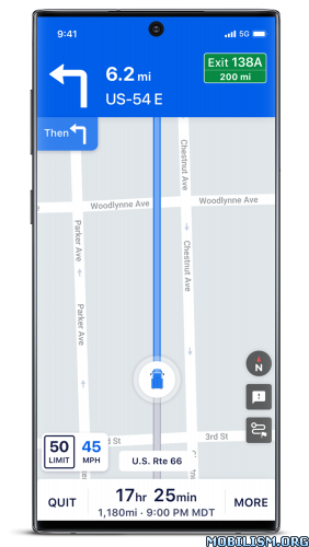
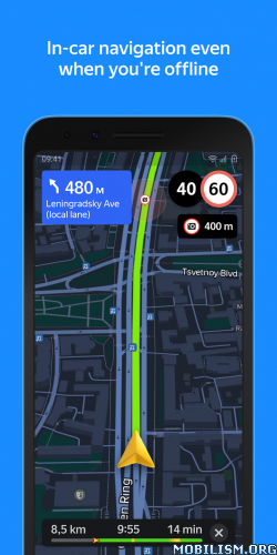
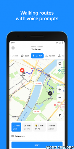
Overview: Waze is the world’s largest community-based traffic and navigation app. Join drivers in your area who share real-time traffic & road info to save time, gas money, and improve daily commuting for all.

Image

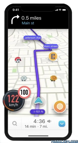
Just by driving with Waze open, you’re already contributing tons of real-time traffic information to your local community. You can also actively report accidents, police traps and other hazards you see on the road. Get road alerts along your route and find the cheapest gas prices around you shared by the community. Plus, you can add friends, send locations or keep others posted on your arrival time.

– Live routing based on community driven, real-time traffic & road info
– Community reported alerts including accidents, hazards, police traps, road closures, and more
– Turn-by-turn voice guided navigation
– Live maps, consistently edited and updated by Waze community map editors
– Automatic rerouting as conditions change on the road
– Send your ETA & real-time drive to update those you’re meeting
– Learns your frequent destinations, commuting hours, and preferred routes
– Find the cheapest gas station on your route
– Add information on local places and businesses
– Add Facebook friends and sync Contacts
– See friends’ ETA when driving to the same destination
– One tap navigation to Facebook & Calendar events
– Earn points as you contribute road info and climb the ranks in your community

Waze is all about contributing to and benefiting from the common good, so hop on board and get involved!

Note: Continued use of GPS running in the background can dramatically decrease battery life. Waze will automatically shut down if you run it in the background and haven’t driven for a while.

Learn more about the Waze privacy policy, including what information is accessed and how it is used. With Waze, you have full control over your privacy settings. _http://www.waze.com/legal/privacy/

★ Untouched apk with Original Hash Signature
★ Certificate MD5 digest: 973cbf4c6cc7c602486328f140c781ea
★ No changes were applied
➡ Languages: Full Multi Languages
➡ CPU architectures: arm64-v8a, armeabi-v7a
➡ Screen DPIs: 120dpi, 160dpi, 240dpi, 320dpi, 480dpi, 640dpi


What’s New:
New RC#2 4.101.0.1 release. Please visit Waze Discuss for full release notes and to submit your feedback.

Fixed:
– Stability and crash fixes

This app has banner advertisements

More Info:
https://play.google.com/store/apps/details?id=com.waze

Download Instructions:
https://ouo.io/hjW2HF

Mirror:
https://ouo.io/2h6JSd
https://ouo.io/DsJpor4
https://rapidgator.net/file/f88c686a1bc … 7.apk.html.

Download Trucker Path: Truck GPS & Maps v6.2.1 [Subscribed] [Mod Extra]

Trucker Path: Truck GPS & Maps v6.2.1 [Subscribed] [Mod Extra]
Requirements: 8.0+
Overview: America’s most popular app for Truckers, made by Truckers!

Image

Reach destinations quicker and spend more time with family. Search truck stops: Flying J, Pilot, Loves truck, Travel Plazas or Petro TA, Blue Beacon, weigh stations & scales, check fuel prices, rest areas, real-time parking availability, and GPS.
All trucker tools in one FREE App – Keep trucking with Trucker Path, Best Trucking App!

JOIN THE COMMUNITY of 600,000+ truck drivers now! Like CB Radio, but better.

TRUCK STOP LOCATOR APP
★ Find popular Truckstops: Petro, Pilot, Flying J, Loves, TA Truck, Travel Plazas, AM Best
★ Hundreds of independent truck stops with reviews from fellow truckers
★ Truck Stops with showers
★ Rest Areas
★ Check nearby weather

AVAILABLE TRUCK PARKING
★ Real-time truck parking availability
★ Truck parking status history
★ Book truck parking in advance at some stops
★ WALMART Locations with overnight truck parking

WEIGH STATIONS & SCALES
★ See which weigh stations are open or closed
★ Check weigh stations status history
★ Find truck weigh scales

FUEL STOPS WITH TRUCK CLEARANCE
★ Find fuel stations with diesel
★ Compare fuel prices
★ All featured fuel stations have clearance for trucks

TRIP PLANNER
★ Plan ahead with Trucker Path GPS
★ Find Low Clearance Bridges
★ Truck Wash Locator for trailer washout: Blue Beacon or Tanker Wash
★ Hotels & Restaurants
★ Soon to be added: Truck Navigation

FUEL FINDER
★ Find nearest fuel stops
★ All fuel stations have truck clearance
★ Check fuel prices – updated every 30 min

Our platform features 6,000+ Truck Stops in the U.S. and Canada:
Pilot Flying J
Loves Truck Stops
TA Truck
Petro
AM Best
Petro-Canada
Roady’s
Thousands of independent truck stops

Our users say that Trucker Path is easier to use than most similar apps like Smart truck, DAT Trucker, All Truck Stops, or Trucker Tools. And it’s FREE!

Trucker Path is a truck navigation (Truck GPS) tool geared towards professional Truck Drivers. It provides best trucker tools on all the main (Flying J, Pilot, Loves and TA) and independent Truckstop, Weigh Stations, truck parking space availability, directions, phone/fax numbers, restaurants nearby, types of truck care provided, Transflo, weather, diesel prices, etc. It also contains information about rest areas, truck wash stations, scales, diesel prices, restaurants, hotels/motels, and allows truckers to plan their diesel costs and other stops with Trip Planner. It’s never been easier to find truck stops, fuel stops.
Trucker Path is the most popular apps for truckers featured by CDL Life, Overdrive Magazine, The Trucker, The New York Times, and others.

Keep trucking!

Truckloads is a free load board that helps truck drivers find new loads. More than 90,000 carriers already use it.

What’s New:
– Bug fixes and performance enhancements

Mod Info:
  • Diamond Subscription unlocked;
  • Disabled / Removed unwanted Permissions + Receivers + Providers + Services;
  • Optimized and zipaligned graphics and cleaned resources for fast load;
  • Ads Permissions / Services / Providers removed from Android.manifest;
  • Ads links removed and invokes methods nullified;
  • Ads layouts visibility disabled;
  • Google Maps Location works;
  • Google Play Store install package check disabled;
  • Debug code removed;
  • Update disabled;
  • Remove default .source tags name of the corresponding java files;
  • Analytics / Crashlytics / Firebase disabled;
  • Languages: Full Multi Languages;
  • CPUs: armeabi-v7a, arm64-v8a;
  • Screen DPIs: 120dpi, 160dpi, 240dpi, 320dpi, 480dpi, 640dpi;
  • Original package signature changed;
  • Release by Balatan.


This app has no advertisements

More Info:
https://play.google.com/store/apps/details?id=com.sixdays.truckerpath

Download Instructions:
https://ouo.io/Xepjmx5

Mirrors:
https://ouo.io/A7QOH6
https://ouo.io/zuvOzM
https://ouo.io/OYdz65
https://ouo.io/nte5sw
https://ouo.io/3owSOx
https://ouo.io/jQWUcSP
https://ouo.io/xsQ5KkO.

Download Altimeter professional v4.9.4 [PRO]

Altimeter professional v4.9.4 [PRO]
Requirements: 4.4 and up
Overview: Professional altimeter. Very accurate position and altitude detection

Image

Through this Altimeter application you will be able to know the real height of where you are. Very accurate from a graphic point of view, it reproposes an analogue altimeter with digital measurement. It also stores the maximum height reached, very useful for hiking in the mountains. You can also view the quality and accuracy at any time. It uses both the GPS and the barometric sensor (for devices equipped) that can be activated by the options.
You can see the altitude in meters or feet and calibrate the altitude from the settings panel.
You will be able to record the altitude trend over time and view the relative graph, also monitoring the trend of the weather forecast based on the barometric pressure with the histogram graph.
With the function take photos, you can take personalized photographs (with the altitude and the place where you are), share them with facebook, whatsapp, email etc.
Possibility to send an SMS in case of need to a contact you have chosen with GPS coordinates and your position on the map.
Very interesting is also the use of the widget to be installed in the screen to keep the altitude under control.

Some features:
– Professional algorithm for precise altitude detection in real time
– Trend in altitude time for excursions and walks
– SMS Alert system in case of need by sending the position to a chosen contact
– Accurate and real-time weather forecasts
– Function takes photos with superimposed data
– Widget

What’s New:
– new graphs on the route (speed, average speed indicators, increase in altitude and percentage of activity performed)
– saving routes with all data (altitude trend, map positions, average speed data, altitude variation)
– added satellite histogram chart
– Bugfixes and optimizations

☆PRO features unlocked
☆Ads Layout removed/Ad activity Removed
☆Optimized Graphics/Zipaligned
☆Remove default .source name of java files;
☆Cleaned Package for fast load
☆Debug Info Removed


This app has no advertisements

More Info:
https://play.google.com/store/apps/details?id=com.ffz.altimetrofree

Download Instructions:
https://ouo.io/Rd6XEd

mirror:
https://ouo.io/nEvoPP
https://ouo.io/EBueuo
https://ouo.io/TWfPQf2
https://ouo.io/FuMp4F

Download Yandex Maps and Navigator v17.3.0 [Mod]

Yandex Maps and Navigator v17.3.0 [Mod]
Requirements: 6.0+
Overview: Yandex Maps is the ultimate app for navigating the city around you. Yandex Maps is packed with useful features that can help you get around with comfort and ease. Find the addresses you need or the best places nearby even when you’re offline with Yandex Maps.

Image Image

Yandex Maps is the ultimate app for navigating the city around you. Yandex Maps is packed with useful features that can help you get around with comfort and ease. There’s Navigator, with info on traffic jams and cameras, and voice assistant Alice. There’s searching for places by address, name, or category. There’s public transport like buses, trolleybuses, and trams moving on the map in real time. Pick any mode of transport to get to your destination. Or create a walking route if you feel like it.

Navigator
• Real-time traffic forecasts to get you moving and avoid traffic jams.
• Voice prompts for turns, cameras, speed limits, accidents, and roadworks to help you navigate without looking at the screen.
• Alice is also on board: she’ll help you find a place, create a route, or call a number from your contact list.
• The app recommends faster routes if the traffic conditions have changed.
• To navigate offline, simply download an offline map.
• You can use the app on your car screen via Android Auto.
• City parking and parking fees.
• Pay for gas in the app at over 8000 gas stations across Russia.

Search for places and businesses
• Easily search the business directory using filters and get detailed address results with entrances and driveways.
• Find everything you need to know about a business: contact information, working hours, list of services, photos, visitor reviews, and rating.
• Check the indoor maps of large shopping malls, train stations, and airports.
• No internet? Search with an offline map.
• Save cafes, shops, and other favorite spots to My places and view them on other devices.

Public transport
• Track buses, trams, trolleybuses, and minibuses in real time.
• Choose to display only selected routes.
• Get your public transport schedule for the next 30 days.
• Check the expected arrival time at your stop.
• Find public transport stops, metro stations, and other important facilities.
• Learn in advance about congestion in metro stations.
• Get information about the most convenient exits and transfers on your route.
• Check if you need the first or last metro car – a nifty feature for people traveling by metro in Moscow, Novosibirsk, or Saint Petersburg.

Routes for any mode of transport
• By car: Navigation that accounts for traffic conditions and camera warnings.
• On foot: Voice prompts make it easier to enjoy a walk without looking at the screen.
• By public transport: Track your bus or tram in real time and check expected arrival times.
• By bike: Be warned about crossings and exits to motorways.
• On a scooter: We’ll suggest bikeways and sidewalks and help you avoid stairs where possible.

Making cities more convenient
• Book appointments at beauty salons online, at any time of day (or night!).
• Order food from cafes and restaurants and collect it on your way home or to work.
• Book electric scooters to ride around Moscow and Krasnodar.
• Order a taxi directly from the app.

And more
• Download maps to create driving routes and search for places and addresses offline.
• Never get lost in unfamiliar places with street panoramas and 3D mode.
• Switch between map types (Map, Satellite, or Hybrid) depending on the situation.
• Use the app in Russian, English, Turkish, Ukrainian, or Uzbek.
• Find your way easily in Moscow, Saint Petersburg, Novosibirsk, Krasnoyarsk, Omsk, Ufa, Perm, Chelyabinsk, Yekaterinburg, Kazan, Rostov-on-Don, Volgograd, Krasnodar, Voronezh, Samara, and other cities.

We’re always happy to receive your feedback. Send your suggestions and comments to app-maps@support.yandex.ru. We do read them and reply!

★★★ MOD ★★★

● Hidden ad units that managed to hide
● Removed unnecessary analytics
● Cleaned up and optimized graphics
● Cleaned up all kinds of rubbish, carefully
● Optimized application manifest
● Languages: be, en, ru, tr, uk, kk, etc.
● Signature changed


What’s New:
When you’re ordering a taxi, Yandex Maps now suggests pickup spots that are convenient for both you and the driver. You’ll see which ensure a quicker or more affordable route to your destination, though you can always make an adjustment yourself if nothing fits.

This app has no advertisements

More Info:
https://play.google.com/store/apps/details?id=ru.yandex.yandexmaps&hl=en

Download Instructions: credit Alex.Strannik
armeabi-v7a:
https://ouo.io/5pGqVs

Mirrors:
https://ouo.io/R2T1jU
https://ouo.io/qzpD5sL
https://rapidgator.net/file/77bd71354a1 … a.apk.html

arm64-v8a:
https://ouo.io/hQymNh

Mirror:
https://ouo.io/PuE6D6
https://ouo.io/KNX01T
https://rapidgator.net/file/f260fd4e729 … a.apk.html.

Download GPX Viewer PRO v1.45.4 [Paid] [Patched] [Unlocked]

GPX Viewer PRO v1.45.4 [Paid] [Patched] [Unlocked]
Requirements: 5.0+
Overview: This simple application loads tracks, routes and waypoints from gpx, kml, kmz and loc files and draws them on different map types such as Google Maps, Mapbox, HERE and many types of OpenStreetMaps. Application shows detailed information about each track, route and waypoint. It also supports showing current GPS position on a map and continuously follows that position, so it can be used as a simple navigation.

Image Image Image Image

View gpx, kml, kmz, loc files, but get a lot more features. See why we are one of the best rated offline vector maps app. GPX Viewer PRO is the ultimate GPS locator, GPS tracks viewer, analyzer, recorder, tracker and simple navigation tool for your trips and outdoor activities.

GPX, KML, KMZ AND LOC
• view tracks, routes and waypoints from gpx, kml, kmz and loc files
• file browser which opens multiple files and has support for favorite files and history
• compress gpx files into gpz and kml files into kmz (zip archives)

DETAILED TRIP STATS
• analyze information and statistics for tracks and routes
• view graphs (charts) like elevation profile and speed profile for tracks and routes
• view graphs of other track data like cadence, heart rate, power and air temperature
• analyze information for waypoints and adjust their icons
• change track and route color
• colorize track and route line by elevation, speed, cadence, heart rate or air temperature

ONLINE MAPS
• online maps such as Google Maps, Mapbox, HERE, Thunderforest and some others based on OpenStreetMap data, preview: _https://sh.vecturagames.com/online
• OpenWeatherMap weather layers and overlays
• add your custom online TMS or WMS maps

SIMPLE NAVIGATION TOOL
• show current GPS position on a map
• follow GPS position continuously by adjusting map position
• rotate map according to device orientation sensor or according to movement direction data from GPS
• with follow GPS position and rotate map features, GPX Viewer PRO can be used as a simple navigation tool
• notification when GPS position is near waypoint with adjustable distance

OFFLINE MAPS (PRO ONLY)
• detailed worldwide offline vector maps based on OpenStreetMap data
• wide variety of offline map styles from city to outdoor oriented styles, preview: _https://sh.vecturagames.com/offline
• monthly updates with improved data

TRACK RECORDING (PRO ONLY)
• record and export your trips into gpx or kml files
• record elevation and speed statistics
• adjustable recording profiles for various outdoor activities
• distance or time voice notification

———

GPX Viewer PRO is highly customizable. You can set everything according to your needs!

If you want feature rich gpx viewer that is also offline maps app & tool with simple navigation, vector offline maps, GPS locator, GPS tracks viewer, trip stats viewer, GPS tracker and has other useful features, GPX Viewer PRO is the best app for that!

User Guide:
_https://docs.vecturagames.com/gpxviewer

User Support:
_https://support.vecturagames.com/gpxviewer

What’s New:
• Added support for Android 14
• PRO Added support for showing information of Points of interest by tapping on their icons in offline map mode
• Updated multiple translations
• Updated 3rd party libraries
• Bug fixes

This app has no advertisements

More Info:
https://play.google.com/store/apps/details?id=com.vecturagames.android.app.gpxviewer.pro&hl=en

Download Instructions: credit Timozhai
arm64-v8a armeabi-v7a:
https://ouo.io/E3BMsz

Mirror:
https://ouo.io/95GdHf
https://ouo.io/Su763K7
https://rapidgator.net/file/3c30ff75d7b … d.apk.html.