Download OsmAnd+ — Maps & GPS Offline v4.6.13 [OsmAnd Live] [Mod Extra]

OsmAnd+ — Maps & GPS Offline v4.6.13 [OsmAnd Live] [Mod Extra]
Requirements: 6.0+
Overview: Osmand is opensource navigation application with raster/vector maps
ImageImage

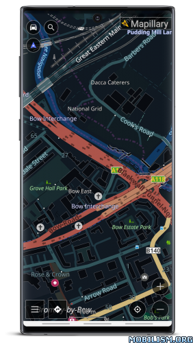
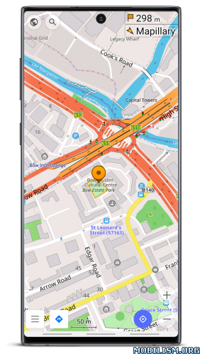
Osmand+ is an open source navigation application with access to a wide variety of global open street map data. All map data (vector or tile maps) can be stored on the phone memory card for offline usage. Osmand also offers offline and online routing functionality including voice guidance.
Osmand+ is the paid application version, by buying it you support the project, fund the development of new features, and receive the latest updates.
Some of the core features:
– Complete offline functionality (store downloaded vector or tile maps in a selectable folder)
– Compact offline vector maps for the whole world available
– Unlimited downloading of country or region maps directly from the app
– Offline Wikipedia feature (download Wikipedia POIs), great for sightseeing
– Overlay of several map layers possible, like GPX or navigation tracks, Points of Interest, favorites, contour lines, public transportation stops, additional maps with customizable transparency
– Offline search for addresses and places (POIs)
– Offline routing for short distances (experimental)
– Car, bicycle, and pedestrian modes with:
– Optional automated day/night view switching
– Optional speed-dependent map zooming
– Optional map alignment according to compass or direction of motion

What’s New:
• Android Auto: Added 3D mode
• Tracks: Introduced filters and smart folders, optimized memory for larger files
• Enhanced top and bottom widget panels to accommodate all widgets
• Improved local resource management
• Customizable button mapping for external controllers
• New widgets: "Glide Ratio" and "Sun Position"
• OsmAnd Cloud: Now access deleted files
• Enhanced track coloring in Slope mode with new symmetric gradient
• Resolved issues with transparent status bar

Mod Info:
  • OsmAnd Live / Paid features unlocked;
  • Disabled / Removed unwanted Permissions + Receivers + Providers + Services;
  • Optimized and zipaligned graphics and cleaned resources for fast load;
  • Debug code removed;
  • Analytics disabled;
  • AOSP compatible mode;
  • Languages: Full Multi Languages;
  • CPUs: armeabi-v7a, arm64-v8a, x86, x86_64;
  • Screen DPIs: 160dpi, 240dpi, 320dpi, 480dpi, 640dpi;
  • Original package signature changed;
  • Release by Balatan.


This app has no advertisements

More Info:
https://play.google.com/store/apps/details?id=net.osmand.plus

Download Instructions:
All-in-One: armeabi-v7a, arm64-v8a, x86, x86_64:
https://ouo.io/Lmb34K

Mirrors:
https://ouo.io/FLd9lQ
https://ouo.io/EWo24E
https://ouo.io/1NiVGUk
https://ouo.io/LmZUOdO
https://ouo.io/LXwNUiO
https://ouo.io/RFIxAc9
https://ouo.io/3LGWUG

armeabi-v7a:
https://ouo.io/A7k9YP

Mirrors:
https://ouo.io/aAngIA
https://ouo.io/jc4h7tq
https://ouo.io/D6IpjN
https://ouo.io/jsNKlx3
https://ouo.io/QxF6mB
https://ouo.io/jmbmB4x
https://ouo.io/WrGglX

arm64-v8a:
https://ouo.io/M7QJb5s

Mirrors:
https://ouo.io/r8iNoU
https://ouo.io/8Naqj9
https://ouo.io/F1Iw6a
https://ouo.io/VHA57V
https://ouo.io/kVrFz6G
https://ouo.io/zXdL3J
https://ouo.io/lSneGhX.
Download OsmAnd — Maps & GPS Offline v4.6.13 [Pro Plus]

OsmAnd — Maps & GPS Offline v4.6.13 [Pro Plus]
Requirements: 6.0+
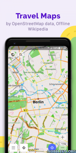
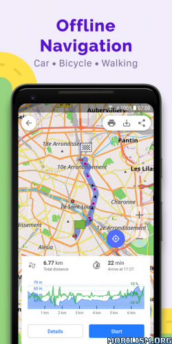
Overview: OsmAnd is an offline world map application based on OpenStreetMap (OSM), which allows you to navigate taking into account the preferred roads and vehicle dimensions.

Image Image Image Image

OsmAnd is an offline world map application based on OpenStreetMap (OSM), which allows you to navigate taking into account the preferred roads and vehicle dimensions. Plan routes based on inclines and record GPX tracks without an internet connection.
OsmAnd is an open source app. We do not collect user data and you decide what data the app will have access to.

Main features:

Map view
• Choice of places to be displayed on the map: attractions, food, health and more;
• Search for places by address, name, coordinates, or category;
• Map styles for the convenience of different activities: touring view, nautical map, winter and ski, topographic, desert, off-road, and others;
• Shading relief and plug-in contour lines;
• Ability to overlay different sources of maps on top of each other;

GPS Navigation
• Plotting a route to a place without an Internet connection;
• Customizable navigation profiles for different vehicles: cars, motorcycles, bicycles, 4×4, pedestrians, boats, public transport, and more;
• Change the constructed route, taking into account the exclusion of certain roads or road surfaces;
• Customizable information widgets about the route: distance, speed, remaining travel time, distance to turn, and more;

Route Planning and Recording
• Plotting a route point by point using one or multiple navigation profiles;
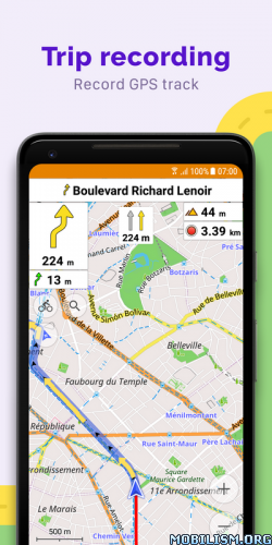
• Route recording using GPX tracks;
• Manage GPX tracks: displaying your own or imported GPX tracks on the map, navigating through them;
• Visual data about the route – descents/ascents, distances;
• Ability to share GPX track in OpenStreetMap;

Creation of points with different functionality
• Favourites;
• Markers;
• Audio/video notes;

OpenStreetMap
• Making edits to OSM;
• Updating maps with a frequency of up to one hour;

Additional features
• Compass and radius ruler;
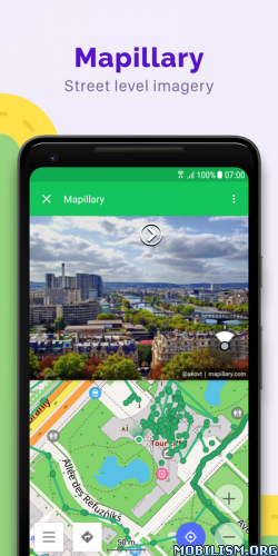
• Mapillary interface;
• Night theme;
• Wikipedia;
• Large community of users around the world, documentation, and support;

Paid features:

Maps+ (in-app or subscription)
• Android Auto support;
• Unlimited map downloads;
• Topo data (Contour lines and Terrain);
• Nautical depths;
• Offline Wikipedia;
• Offline Wikivoyage – Travel guides.

OsmAnd Pro (subscription)
• OsmAnd Cloud (backup and restore);
• Cross-platform;
• Hourly map updates;
• Weather plugin;
• Elevation widget;
• Customise route line;
• External sensors support (ANT+, Bluetooth);
• Online Elevation profile.

★ Pro / Plus / OsmAnd Live / Paid features Unlocked
★ .source attributes of the corresponding java files removed
★ All Debug code removed
★ Original package signature changed
➡ Languages: Full Multi Languages
➡ CPU architectures: arm64-v8a, armeabi-v7a, x86, x86_64
➡ Screen DPIs: 120dpi, 160dpi, 240dpi, 320dpi, 480dpi, 640dpi


What’s New:
• Android Auto: Added 3D mode
• Tracks: Introduced filters and smart folders, optimized memory for larger files
• Enhanced top and bottom widget panels to accommodate all widgets
• Improved local resource management
• Customizable button mapping for external controllers
• New widgets: "Glide Ratio" and "Sun Position"
• OsmAnd Cloud: Now access deleted files
• Enhanced track coloring in Slope mode with new symmetric gradient
• Resolved issues with transparent status bar

This app has no advertisements

More Info:
https://play.google.com/store/apps/details?id=net.osmand&hl=en

Download Instructions:
arm64-v8a armeabi-v7a x86 x86_64:
https://ouo.io/uULnAm

Mirrors:
https://ouo.io/Y9Dmya
https://ouo.io/EPD31k
https://ouo.io/DsTaqCT

armeabi-v7a:
https://ouo.io/r1pBHE

Mirror:
https://ouo.io/QdrnMa
https://ouo.io/x9ntRM
https://ouo.io/IFcGQA

arm64-v8a:
https://ouo.io/6mJX8u

Mirror:
https://ouo.io/mkSem9
https://ouo.io/N2nbIp
https://ouo.io/UVD078.

Download OsmAnd+ — Maps & GPS Offline v4.6.12 [OsmAnd Live] [Mod Extra]

OsmAnd+ — Maps & GPS Offline v4.6.12 [OsmAnd Live] [Mod Extra]
Requirements: 6.0+
Overview: Osmand is opensource navigation application with raster/vector maps

ImageImage

Osmand+ is an open source navigation application with access to a wide variety of global open street map data. All map data (vector or tile maps) can be stored on the phone memory card for offline usage. Osmand also offers offline and online routing functionality including voice guidance.
Osmand+ is the paid application version, by buying it you support the project, fund the development of new features, and receive the latest updates.
Some of the core features:
– Complete offline functionality (store downloaded vector or tile maps in a selectable folder)
– Compact offline vector maps for the whole world available
– Unlimited downloading of country or region maps directly from the app
– Offline Wikipedia feature (download Wikipedia POIs), great for sightseeing
– Overlay of several map layers possible, like GPX or navigation tracks, Points of Interest, favorites, contour lines, public transportation stops, additional maps with customizable transparency
– Offline search for addresses and places (POIs)
– Offline routing for short distances (experimental)
– Car, bicycle, and pedestrian modes with:
– Optional automated day/night view switching
– Optional speed-dependent map zooming
– Optional map alignment according to compass or direction of motion

What’s New:
• Android Auto: Added 3D mode
• Tracks: Introduced filters and smart folders, optimized memory for larger files
• Enhanced top and bottom widget panels to accommodate all widgets
• Improved local resource management
• Customizable button mapping for external controllers
• New widgets: "Glide Ratio" and "Sun Position"
• OsmAnd Cloud: Now access deleted files
• Enhanced track coloring in Slope mode with new symmetric gradient
• Resolved issues with transparent status bar

Mod Info:
  • OsmAnd Live / Paid features unlocked;
  • Disabled / Removed unwanted Permissions + Receivers + Providers + Services;
  • Optimized and zipaligned graphics and cleaned resources for fast load;
  • Debug code removed;
  • Analytics disabled;
  • AOSP compatible mode;
  • Languages: Full Multi Languages;
  • CPUs: armeabi-v7a, arm64-v8a, x86, x86_64;
  • Screen DPIs: 160dpi, 240dpi, 320dpi, 480dpi, 640dpi;
  • Original package signature changed;
  • Release by Balatan.


This app has no advertisements

More Info:
https://play.google.com/store/apps/details?id=net.osmand.plus

Download Instructions:
All-in-One: armeabi-v7a, arm64-v8a, x86, x86_64:
https://ouo.io/AKVjaZg

Mirrors:
https://ouo.io/ZC8RkFU
https://ouo.io/EeU5WB
https://ouo.io/HxjXrH
https://ouo.io/1yjFAD
https://ouo.io/hoEV8D
https://ouo.io/h1G6ZE

armeabi-v7a:
https://ouo.io/vl6gr4

Mirrors:
https://ouo.io/Afk49H
https://ouo.io/2grL9Vz
https://ouo.io/mwHs1vU
https://ouo.io/f7UaXV
https://ouo.io/GfSqtH
https://ouo.io/c1ZbtWA

arm64-v8a:
https://ouo.io/7sOn9G

Mirrors:
https://ouo.io/0H4oCB
https://ouo.io/cByNbM
https://ouo.io/7ui9YA
https://ouo.io/S7KiLX
https://ouo.io/uZ9tDnm
https://ouo.io/fueZuT6.

Download Altimeter professional v4.9.3 [PRO]

Altimeter professional v4.9.3 [PRO]
Requirements: 4.4 and up
Overview: Professional altimeter. Very accurate position and altitude detection

Image

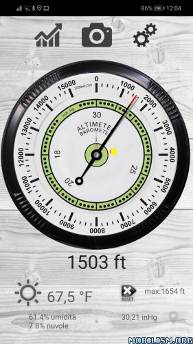
Through this Altimeter application you will be able to know the real height of where you are. Very accurate from a graphic point of view, it reproposes an analogue altimeter with digital measurement. It also stores the maximum height reached, very useful for hiking in the mountains. You can also view the quality and accuracy at any time. It uses both the GPS and the barometric sensor (for devices equipped) that can be activated by the options.
You can see the altitude in meters or feet and calibrate the altitude from the settings panel.
You will be able to record the altitude trend over time and view the relative graph, also monitoring the trend of the weather forecast based on the barometric pressure with the histogram graph.
With the function take photos, you can take personalized photographs (with the altitude and the place where you are), share them with facebook, whatsapp, email etc.
Possibility to send an SMS in case of need to a contact you have chosen with GPS coordinates and your position on the map.
Very interesting is also the use of the widget to be installed in the screen to keep the altitude under control.

Some features:
– Professional algorithm for precise altitude detection in real time
– Trend in altitude time for excursions and walks
– SMS Alert system in case of need by sending the position to a chosen contact
– Accurate and real-time weather forecasts
– Function takes photos with superimposed data
– Widget

What’s New:
– new graphs on the route (speed, average speed indicators, increase in altitude and percentage of activity performed)
– saving routes with all data (altitude trend, map positions, average speed data, altitude variation)
– added satellite histogram chart
– Bugfixes and optimizations

☆PRO features unlocked
☆Ads Layout removed/Ad activity Removed
☆Optimized Graphics/Zipaligned
☆Remove default .source name of java files;
☆Cleaned Package for fast load
☆Debug Info Removed


This app has no advertisements

More Info:
https://play.google.com/store/apps/details?id=com.ffz.altimetrofree

Download Instructions:
https://ouo.io/s6iEBU

mirror:
https://ouo.io/BksROX
https://ouo.io/Ic2JGI
https://ouo.io/2o5rJJ
https://ouo.io/hIoB4im

Download Mock Locations (fake GPS path) v1.21.0 [Premium]

Mock Locations (fake GPS path) v1.21.0 [Premium]
Requirements: 4.4+
Overview: Mock Locations allows you to fake information about the location of your phone by GPS and network operator.

Image

Fake location of your phone by GPS and network operator.

Mock Locations allows you to fake information about the location of your phone by GPS and network operator.

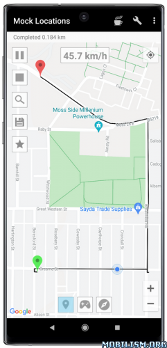
You simply navigate the route on the map and press the "Go!" to have all of the application on your phone to give fake information about the location.

This will help in the development of applications or if you want to, no one knew where you are really.

Attention! Before purchasing the full version of the application check the performance on your device. For this purpose there is a free trial period of 24 hours after installing the app. During this time, you can use the premium features (Hide the application using "Hide Mock Locations", or move the app to the system partition and run without setting Allow mock location). Buy the full version only after making sure that my application works correctly on your device.

On devices with Root access can use the app without a tick "Allow mock locations". (The free version of the application, this function is available for 24 hours after installation.)

To do this you need to move the application to the system partition. This is most easily done by using "System App Converter" program (_https://play.google.com/store/apps/details?id=com.appzdevelopers.sysappconverterf).

Just move the application to the system partition can be manually (Using Root Explorer):
On Android 2.3.3 – 4.3: move the file "ru.gavrikov.mocklocations.apk" from the folder "/data/app" in the folder "/system/app" and reboot the device.
On Android 4.4 – 4.4.4: move the file "ru.gavrikov.mocklocations.apk" from the folder "/data/app" in the folder in the folder "/system/priv-app" and reboot the device.

Even you can hide Mock Locations app work on other applications (in this case they will not see what is on tick "Allow mock locations"). This can be done with the help of my application Hide Mock Locations (_https://play.google.com/store/apps/details?id=ru.gavrikov.hidemocklocations).Attention!!! It works through the Xposed framework.

There are times when your jump coordinates to the actual location. This happens on some devices after the application was transferred to the system partition.
First solution:
In the setting of the device to enter in Location tab and turn off location for wireless networks. And use the application in areas where there is no real GPS signal.
Second solution:
Step 1: Completely delete the app "Mock Locations" from the device.
Step 2: Re-install it from Google Play Market.
Step 3: The developer settings, enable "Allow mock locations".
Step 4: Install my application "Hide Mock Locations" (it works through the Xposed Framework).
Step 5: Install the Xposed Framework.
Step 6: Open Xposed. Activate module "Hide Mock Locations". Reload this device.
Step 7: Open the application "Hide Mock Locations". Choose from any application to hide the setting "Allow mock locations"
Step 8: Close all applications or reboot your device.
Step 9: Use the "Mock Locations" application.

Features:
– Emulation GPS location and according to the service provider.
– Ability to create a route on roads.
– Ability to set breakpoints and specify the stay in them.
– Ability to set a variable speed.
– Closed route. (Allows you to build a route for movement along a closed path. To do this, lay the route so that the start and end points were near.)
– You can use the braking before bends. (Settings -> Slows down before the turn)
– You can run the emulation location at one point.
– You can hide an application icon from the status bar. (Settings -> Hide Icon)

Thank Levin Faber and Ben Black for translation into German.
Thank Luca Boscaini for the Italian translation.

★ Premium / Paid features unlocked
★ Ads methods nullified
★ Ads visibility disabled
★ .source attributes of the corresponding java files removed
★ All Debug code removed
➡ Languages: Full Multi Languages
➡ CPU architectures: Universal
➡ Screen DPIs: 120dpi, 160dpi, 240dpi, 320dpi, 480dpi, 640dpi


What’s New:
Bug fix.

This app has no advertisements

More Info:
https://play.google.com/store/apps/details?id=ru.gavrikov.mocklocations&hl=en

Download Instructions:
https://ouo.io/YcfNuG

Mirror:
https://ouo.io/Y8jjC3V
https://ouo.io/wx07Mt6
https://rapidgator.net/file/c4e09e76b9a … d.apk.html.