Download All-In-One Offline Maps v3.9b build 114 [Plus] [Mod Extra]

All-In-One Offline Maps v3.9b build 114 [Plus] [Mod Extra]
Requirements: 2.1+
Overview: Bored to wait for maps to display? Use All-In-One OfflineMaps! Once displayed, maps are stored and remain available, quickly, even with no network access.

Image

• Want more than just roads on your maps? You will find what you need here;
• Used to go to places with poor network coverage? Everything will stay available;
• Used to go abroad? You won’t be lost anymore;
• Have a data allowance limit? It will reduce your usage.
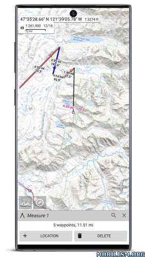
★★ Maps ★★
A lot of maps are available, including classical road maps, topographic maps, aerial (satellite) maps and various layers that can be added over any maps: OpenStreetMap (Roads, Topo), USGS National Map (Hi-res topo, Aerial imagery), Worldwide Military Soviet topo maps, etc.
• All maps can be stacked in layers, with precise opacity control;
• Select and store large areas in few clicks;
• Stored space is clear and can be easily deleted.

★★ Display, store and retrieve unlimited placemarks ★★
You can add various items on the map such as waypoints, icons, routes, areas and tracks.
You can easily manage them using the powerful SD-Card Placemarks Explorer.

★★ On-map GPS Location & Orientation ★★
Your real location and direction are clearly displayed on the map, which can be rotated to match your real orientation (depends on device capabilities).
Easy turn on/off to save battery.

And also:
• Metric, imperial and hybrid distance units;
• GPS Latitude/Longitude and grid coordinate formats (UTM, MGRS, USNG, OSGB Grid, Irish Grid, Swiss Grid, Lambert Grids, DFCI Grid, QTH Maidenhead Locator System, …);
• Ability to import hundreds of coordinate formats from http://www.spatialreference.org;
• On-map grids display;
• Full screen map view;
• Multi-touch zoom;
• …

★★ Need more? ★★
If you are a real adventurer, try AlpineQuest Off-Road Explorer, the complete outdoor solution based on All-In-One OfflineMaps, loaded with a powerful GPS Location Tracker and more: https://www.alpinequest.net/google-play

What’s New:
The complete list is available in the changelog inside the application.

Mod Info:

  • Plus / Paid features unlocked;
  • Disabled / Removed unwanted Permissions + Receivers + Providers + Services;
  • Optimized and zipaligned graphics and cleaned resources for fast load;
  • Google Play Store install package check disabled;
  • Debug code removed;
  • Remove default .source tags name of the corresponding java files;
  • Analytics / Crashlytics / Firebase disabled;
  • Languages: Full Multi Languages;
  • CPUs: universal architecture;
  • Screen DPIs: 120dpi, 160dpi, 240dpi, 320dpi, 480dpi, 640dpi;
  • Original package signature changed;
  • Release by Balatan.

This app has no advertisements

More Info:
https://play.google.com/store/apps/details?id=net.psyberia.offlinemaps

Download Instructions:
https://ouo.io/elx606

Mirrors:
https://ouo.io/04uZOf
https://ouo.io/ahCmmK
https://ouo.io/5K23A2
https://ouo.io/3H4EiZ
https://ouo.io/GQHJ7Rw

Download Waze – GPS, Maps, Traffic Alerts v4.82.0.0 RC [Chuppito Mod] [Clone]

Waze – GPS, Maps, Traffic Alerts v4.82.0.0 RC [Chuppito Mod] [Clone]
Requirements: 5.0 and up
Overview: Waze is the world’s largest community-based traffic and navigation app. Join drivers in your area who share real-time traffic & road info to save time, gas money, and improve daily commuting for all.

Image

Just by driving with Waze open, you’re already contributing tons of real-time traffic information to your local community. You can also actively report accidents, police traps and other hazards you see on the road. Get road alerts along your route and find the cheapest gas prices around you shared by the community. Plus, you can add friends, send locations or keep others posted on your arrival time.

– Live routing based on community driven, real-time traffic & road info
– Community reported alerts including accidents, hazards, police traps, road closures, and more
– Turn-by-turn voice guided navigation
– Live maps, consistently edited and updated by Waze community map editors
– Automatic rerouting as conditions change on the road
– Send your ETA & real-time drive to update those you’re meeting
– Learns your frequent destinations, commuting hours, and preferred routes
– Find the cheapest gas station on your route
– Add information on local places and businesses
– Add Facebook friends and sync Contacts
– See friends’ ETA when driving to the same destination
– One tap navigation to Facebook & Calendar events
– Earn points as you contribute road info and climb the ranks in your community

Waze is all about contributing to and benefiting from the common good, so hop on board and get involved!

Note: Continued use of GPS running in the background can dramatically decrease battery life. Waze will automatically shut down if you run it in the background and haven’t driven for a while.

Learn more about the Waze privacy policy, including what information is accessed and how it is used. With Waze, you have full control over your privacy settings. _http://www.waze.com/legal/privacy/

MOD features:
Decensored Waze version with the following improvements compared to the official version:
– display of the exact location of fixed or mobile speed cameras.
– enlarged speed limit sign for more readability
– Radar sound alert whatever the speed (only in case of speeding with the official version)
– personalized card skin with black background to save battery and improve readability
– Choice of new voices compared to the official version
– Vanessa (unmodified),
– Morgan (Cars voice is pretty cool), if you prefer Morgan’s real voice, delete the folder in waze / sound / french
– Svenska (French voice, sound boosted),
– Srpski (star wars voice the 1st voice after the English voices).
– transparent gray signal button (instead of a solid orange circle in the official version) for more map readability and to avoid the "burn" effect on the AMOLED screen
– possibility to report bad or no limitation by clicking on the speedometer then choose "report" (option absent in official version)
– announcement distance of the modified controls compared to the official version:
– highway at 1500 m
– Fast lanes at 1200 m
– Roads at 1000 m

NB; distance configurable in the "Preferences" file by adjusting these 2 lines:
Alerts.Alert Distanc_: 1000
Alerts.Police Alert Distac_: 1000

Speed ​​camera warnings have been officially banned in France since January 2012, their use is punishable by a fine of 1,500 euros and a withdrawal of 6 points on the driving license.

By installing this version, you remain responsible for its use.
Namely in France according to the law still in force to this day: The police do not have the right to search your smartphone.

★ Package name changed

What’s New:
New RC release 4.82.0.0. Please visit Centercode for full release notes and to submit your feedback.

Fixed:
– Stability fixes and improvements

This app has banner advertisements

More Info:
https://play.google.com/store/apps/details?id=com.waze&hl=en

Download Instructions:
Cloned:
Normal:
https://ouo.io/fhny0T

Mirrors:
https://rapidgator.net/file/495aa41b2e9 … e.apk.html
https://ouo.io/2aQsAFu

Internal:
No more microphone but folders accessible in the internal directory (/storage/emulated/0/Waze)

https://ouo.io/oUd2b1

Mirrors:
https://rapidgator.net/file/495aa41b2e9 … e.apk.html
https://ouo.io/wyaMfe

Download Waze – GPS, Maps, Traffic Alerts v4.82.0.0 RC [Chuppito Mod]

Waze – GPS, Maps, Traffic Alerts v4.82.0.0 RC [Chuppito Mod]
Requirements: 5.0 and up
Overview: Waze is the world’s largest community-based traffic and navigation app. Join drivers in your area who share real-time traffic & road info to save time, gas money, and improve daily commuting for all.

Image

Just by driving with Waze open, you’re already contributing tons of real-time traffic information to your local community. You can also actively report accidents, police traps and other hazards you see on the road. Get road alerts along your route and find the cheapest gas prices around you shared by the community. Plus, you can add friends, send locations or keep others posted on your arrival time.

– Live routing based on community driven, real-time traffic & road info
– Community reported alerts including accidents, hazards, police traps, road closures, and more
– Turn-by-turn voice guided navigation
– Live maps, consistently edited and updated by Waze community map editors
– Automatic rerouting as conditions change on the road
– Send your ETA & real-time drive to update those you’re meeting
– Learns your frequent destinations, commuting hours, and preferred routes
– Find the cheapest gas station on your route
– Add information on local places and businesses
– Add Facebook friends and sync Contacts
– See friends’ ETA when driving to the same destination
– One tap navigation to Facebook & Calendar events
– Earn points as you contribute road info and climb the ranks in your community

Waze is all about contributing to and benefiting from the common good, so hop on board and get involved!

Note: Continued use of GPS running in the background can dramatically decrease battery life. Waze will automatically shut down if you run it in the background and haven’t driven for a while.

Learn more about the Waze privacy policy, including what information is accessed and how it is used. With Waze, you have full control over your privacy settings. _http://www.waze.com/legal/privacy/

MOD features:
Decensored Waze version with the following improvements compared to the official version:
– display of the exact location of fixed or mobile speed cameras.
– enlarged speed limit sign for more readability
– Radar sound alert whatever the speed (only in case of speeding with the official version)
– personalized card skin with black background to save battery and improve readability
– Choice of new voices compared to the official version
– Vanessa (unmodified),
– Morgan (Cars voice is pretty cool), if you prefer Morgan’s real voice, delete the folder in waze / sound / french
– Svenska (French voice, sound boosted),
– Srpski (star wars voice the 1st voice after the English voices).
– transparent gray signal button (instead of a solid orange circle in the official version) for more map readability and to avoid the "burn" effect on the AMOLED screen
– possibility to report bad or no limitation by clicking on the speedometer then choose "report" (option absent in official version)
– announcement distance of the modified controls compared to the official version:
– highway at 1500 m
– Fast lanes at 1200 m
– Roads at 1000 m

NB; distance configurable in the "Preferences" file by adjusting these 2 lines:
Alerts.Alert Distanc_: 1000
Alerts.Police Alert Distac_: 1000

Speed ​​camera warnings have been officially banned in France since January 2012, their use is punishable by a fine of 1,500 euros and a withdrawal of 6 points on the driving license.

By installing this version, you remain responsible for its use.
Namely in France according to the law still in force to this day: The police do not have the right to search your smartphone.

What’s New:
New RC release 4.82.0.0. Please visit Centercode for full release notes and to submit your feedback.

Fixed:
– Stability fixes and improvements

This app has banner advertisements

More Info:
https://play.google.com/store/apps/details?id=com.waze&hl=en

Download Instructions:
Normal:
https://ouo.io/Kt4dfy

Mirrors:
https://rapidgator.net/file/833b861a9a1 … e.apk.html
https://ouo.io/81PBrS7

Internal:
No more microphone but folders accessible in the internal directory (/storage/emulated/0/Waze)

https://ouo.io/uPWKeQ

Mirrors:
https://rapidgator.net/file/459dd128b6e … l.apk.html
https://ouo.io/KnpFfZR

Download Sygic GPS Navigation & Offline Maps v21.1.0 [Premium] [Mod Extra]

Sygic GPS Navigation & Offline Maps v21.1.0 [Premium] [Mod Extra]
Requirements: 5.0+
Overview: Sygic GPS Navigation & Maps is the most advanced GPS navigation app for Android with 3D offline maps from TomTom, accurate door-to-door voice guided navigation and free map updates.

ImageImageImage

Sygic – GPS, Navigation is the world’s most downloaded GPS navigation app, trusted by more than 200 million drivers. Offline 3D maps are stored on your phone for GPS navigation without an internet connection. We update the maps multiple times per year for free, so that you can always rely on Sygic GPS Navigation.

NAVIGATE ANYWHERE, EVEN WITHOUT AN INTERNET CONNECTION
• Offline maps of all countries in the world, from TomTom and other providers
• Free map updates multiple times per year
• Voice-guided GPS navigation with precise directions and spoken street names
• Millions of interesting Places (POI)
• Pedestrian GPS navigation with walking directions and tourist attractions (POI)

CAR CONNECTIVITY
• Sygic is specially optimized to work with built-in infotainment systems compatible with MirrorLink**
• Just connect your phone to your car’s screen and stay focused on the road
• You can use your car’s touchscreen, knobs, or buttons to control the app
• Car manufacturers compatible with MirrorLink: Honda, Volkswagen, Seat, Peugeot, Citroen, Skoda (SmartLink), Suzuki, and others

ESCAPE THE TRAFFIC
• Avoid traffic jams with the most accurate real-time traffic information with data collected from more than 500 million users worldwide*

STAY SAFE
• Advanced safety features make driving in unfamiliar territories easier
• Speed limit warnings show you the current speed limit and the upcoming speed limit changes
• Dynamic Lane Assistant guides you into the correct lane
• Head-up Display (HUD) projects navigation onto the windshield of your car, making driving at night safer **
• Dashcam records the road ahead and automatically saves video in case of an accident**
• Real View Navigation is an augmented reality feature for even better and safer driving experience**
• Cockpit shows you the real-time performance of your car. **
• Real-time route sharing lets you share your estimated time of arrival & current position on a map*

SAVE MONEY ALONG YOUR ROUTE
• Park easily with parking place suggestions and live info about prices and availability*
• Set your fuel type and fill up for the best price with live information about fuel prices*
• Avoid speeding tickets with Speed camera warnings*
• Save money on roaming charges with offline maps

You can test drive all features available in the most popular World + Traffic license for the first 7 days after installation. After 7 days you can continue using the basic features or upgrade to the Lifetime Premium license.

What’s New:
From now on, you can use add-ons on device while you are connected to Android Auto with Premium+.

Mod Info:

  • Premium Subscription / Paid features unlocked;
  • Disabled / Removed unwanted Permissions + Receivers + Providers + Services;
  • Optimized and zipaligned graphics and cleaned resources for fast load;
  • Google Play Store install package check disabled;
  • Debug code removed;
  • Remove default .source tags name of the corresponding java files;
  • Analytics / Crashlytics / Firebase disabled;
  • Native crashlytics removed completely;
  • AOSP compatible mode;
  • Languages: Full Multi Languages;
  • CPUs: armeabi-v7a, arm64-v8a;
  • Screen DPIs: 120dpi, 160dpi, 240dpi, 320dpi, 480dpi, 640dpi;
  • Original package signature changed;
  • Any maps loaded (NT/TA/OS) [credits mrdude];
  • Release by Balatan.

This app has no advertisements

More Info:
https://play.google.com/store/apps/details?id=com.sygic.aura

Download Instructions:
armeabi-v7a:
https://ouo.io/npvW8ao

Mirrors:
https://ouo.io/W1e5p9
https://ouo.io/OE28s1
https://ouo.io/k11uDv
https://ouo.io/jvsZxv
https://ouo.io/6LDOR2

arm64-v8a:
https://ouo.io/IFqTXh

Mirrors:
https://ouo.io/YpM2XG
https://ouo.io/sadFhW
https://ouo.io/t4W88
https://ouo.io/wz3L7xM
https://ouo.io/t2A8XP

Download Locus Map Pro Navigation v3.58.0 [Paid]

Locus Map Pro Navigation v3.58.0 [Paid]
Requirements: 5.0+ | root | Google Play Modded | LP
Overview: An ultimate navigation application for all outdoor enthusiasts – hikers, mountainbikers, mountaineers, trail runners or geocachers.

Image

And not only for them, Locus Map Pro is widely used also by professionals – explorers, travelers or rescue squads all over the world.

Locus Map Pro offers true multi functionality and flexibility:
• advanced navigation capability, supporting online and offline routing services
• unprecedented choice of premium online and offline maps
• advanced map tools – map overlays, offsets, WMS sources support
• tools for monitoring sports activities – track recording, customizable dashboard, audio coach, charts, statistics, support of external BL/ANT+ sensors (GPS, HRM, cadence…)
• worldwide weather 24/7 forecast
• sophisticated tools for geocaching – location tools, online/offline logging, support of trackables, Pocket Queries, spoilers…

Map portfolio:
•LoMaps – offline maps of all the World – switch them to hiking/biking map, winter or city map. FREE DOWNLOAD of the first 3 LoMaps.

Detailed hiking maps and cycling maps of the best world map publishers:
•USA by USGS classic/satellite, NeoTreks (AccuTerra),
•Canada by BackRoad Map Books,
•maps of Great Britain by Ordnance Survey (Explorer, Landranger), Switzerland by SwissTopo, Belgium by IGN Belgium, France by IGN France, Denmark by Kortforsyningen, Iceland by LMI Atlas Map, Netherlands by Map5.nl, Slovenia by PZS Maps, Spain by CNIG maps, Sweden by Lantmäteriet, Poland by Compass, Germany, Austria and North Italy by Kompass, Outdooractive – Summer and Winter maps, Basemap.at and Freytag-Berndt, Czechia and Slovakia by SHOCart and Geodézie Online
and many others…

•support of external maps in MAP, SQLite, TAR, MBT, GEMF, Orux or RMA formats, and of own OpenStreetMap or map themes

Features:

Navigation and guidance
• turn•by•turn voice navigation with support of online/offline routing services
• beeline guidance to a point (on map or by compass) or along a route with notifications

Tracks&Routes
• multi•profile track recording
• charts&statistics
• audio coach – commented workouts
• support of Bluetooth/ANT+ external sensors – HRM, speed/cadence, GPS, NMEA
• route planning
• import/export of routes/tracks from/to various formats (KML, KMZ, GPX…) and web services (Strava, Runkeeper, GPSies, Google Earth, Freelogbook.biz etc…)
• customizable bike computer dashboard

Points
• creating own database – order, search, sort
• import/export in many formats, web services support
• OSM POIs

Map tools
• map overlay, calibration and offsets
• support of various external map formats and coordinate systems
• visualising geotagged photos, OSM notes

Search
• online and offline addresses
• OSM POIs, GeoNames and Wikipedia

Geocaching
• downloading geocaches via Geocaching4Locus add•on
• offline and online logging
• support of waypoints, PocketQuery, trackables, spoilers
• graphic and calculation tools

Live tracking
• private or public sharing of location in real time

And much more
• parking assistant, sunrise/sunset time, world wide weather forecast, NFC tagger, QR code generator…

This app uses the Device Administrator permission.

Locus Map Pro is highly customizable. Everything can be set according to user’s needs. Its functionality can be further extended by numerous Add•ons – Locus Map Watch, Augmented reality, GeoGet/GSAK, Pebble, Munzee etc.

What’s New:
*** Version 3.57 ***
– chg: many smaller updates related to the new file-system
– and many fixes, as usually, thanks all for the bug-reporting!

Instructions after INSTALL:
http://pastebin.com/PcYhr4gG

Package Info:

  • Languages: Full Multi Languages;
  • CPUs: armeabi-v7a, arm64-v8a, x86, x86_64;
  • Screen DPIs: 160dpi, 240dpi, 320dpi, 480dpi, 640dpi;
  • Untouched [Paid] apk with Original Hash Signature, no [Mod] or changes was applied;
  • Certificate MD5 digest: 5abd461b66395862e031a8ab8307fc53

This app has no advertisements

More Info:
https://play.google.com/store/apps/details?id=menion.android.locus.pro

Download Instructions:
https://ouo.io/zwjodJ

Mirrors:
https://ouo.io/4cil9g
https://ouo.io/Yf0QlS
https://ouo.io/82wArwo
https://ouo.io/vAVFjz
https://ouo.io/aoawipv